Miller Hill
| Site Name: | Miller Hill | 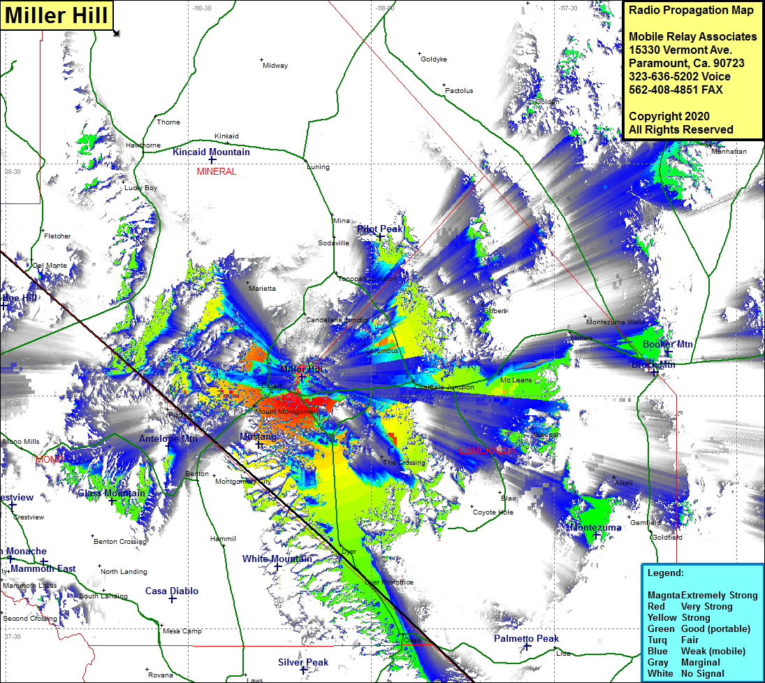 Miller Hill Coverage |
| Latitude: | 038 02 30.0N | 38.0416667 |
| Longitude: | 118 11 18.5W | -118.1884722 |
| Feet | Meters | |
| Ground Elevation: | 7877.0 | 2400.9 |
| HAAT: | 1834.1 | 559.0 |
| City: | Basalt | |
| County: | Mineral | |
| State: | Nevada |
This is not an MRA Owned Site. For space rental contact the site owner.
Do you own or manage this site? Click Here
Would you like to add a site to the Google Earth Map?? Click Here
Site Coverage: Coverage of the southwestern portion of Mineral County, Basalt, Mount Montgomery, Gold Hit, Benton Hot Springs, Pizona, Marietta, Candelaria Jct, Columbus, Gilbert, Coaldale Jct, McLeans, The Crossing, Millers, Montezuma Wells, Tonopah, Dyer, Oasis, Golden, US Highway 6 from Benton to Tonopah, Nevada Highway 264 / 266 to the intersection of California 168