Mt Lewis I
| Site Name: | Mt Lewis I | 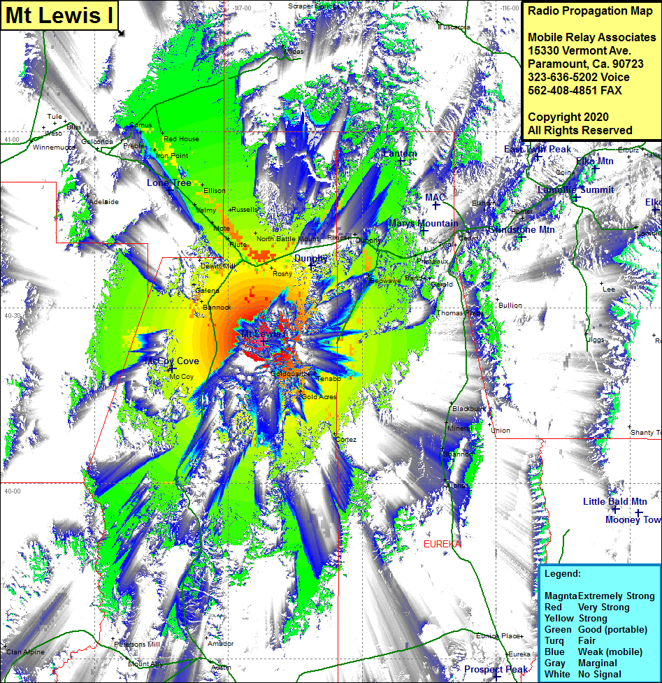 Mt Lewis I Coverage |
| Latitude: | 040 24 13.2N | 40.4036667 |
| Longitude: | 116 52 05.5W | -116.8681944 |
| Feet | Meters | |
| Ground Elevation: | 9610.0 | 2929.1 |
| HAAT: | 3501.4 | 1067.2 |
| City: | Tenabo | |
| County: | Lander | |
| State: | Nevada |
This is not an MRA Owned Site. For space rental contact the site owner.
Do you own or manage this site? Click Here
Would you like to add a site to the Google Earth Map?? Click Here
Site Coverage: Coverage of the northern portion of Lander County, Bannock, McCoy, Copper Basin, Battle Mountain, Rennox, Piute, Mote, Russells, Valmy, Ellison, Knight, Herrin, Iron Point, Red House, Comus, Kampos, Rixies, Dunphy, Beowave, Gold Acres, Tenabo, Cortez, Blackburn, Mineral, Shannon, Alpha, Cluro, Primeaux, Carlin, Vivian, Moleen, Hunter, Nevada Highway 305 from US Highway 50 just outside of Austin to Battle Mountain at the junction of Interstate 80 (Nevada Highway 304), Interstate 80 heading northwest from Battle Montain for 30 miles and most of the highway while heading west for 30 miles to Elko