Mt Rose
| Site Name: | Mt Rose | 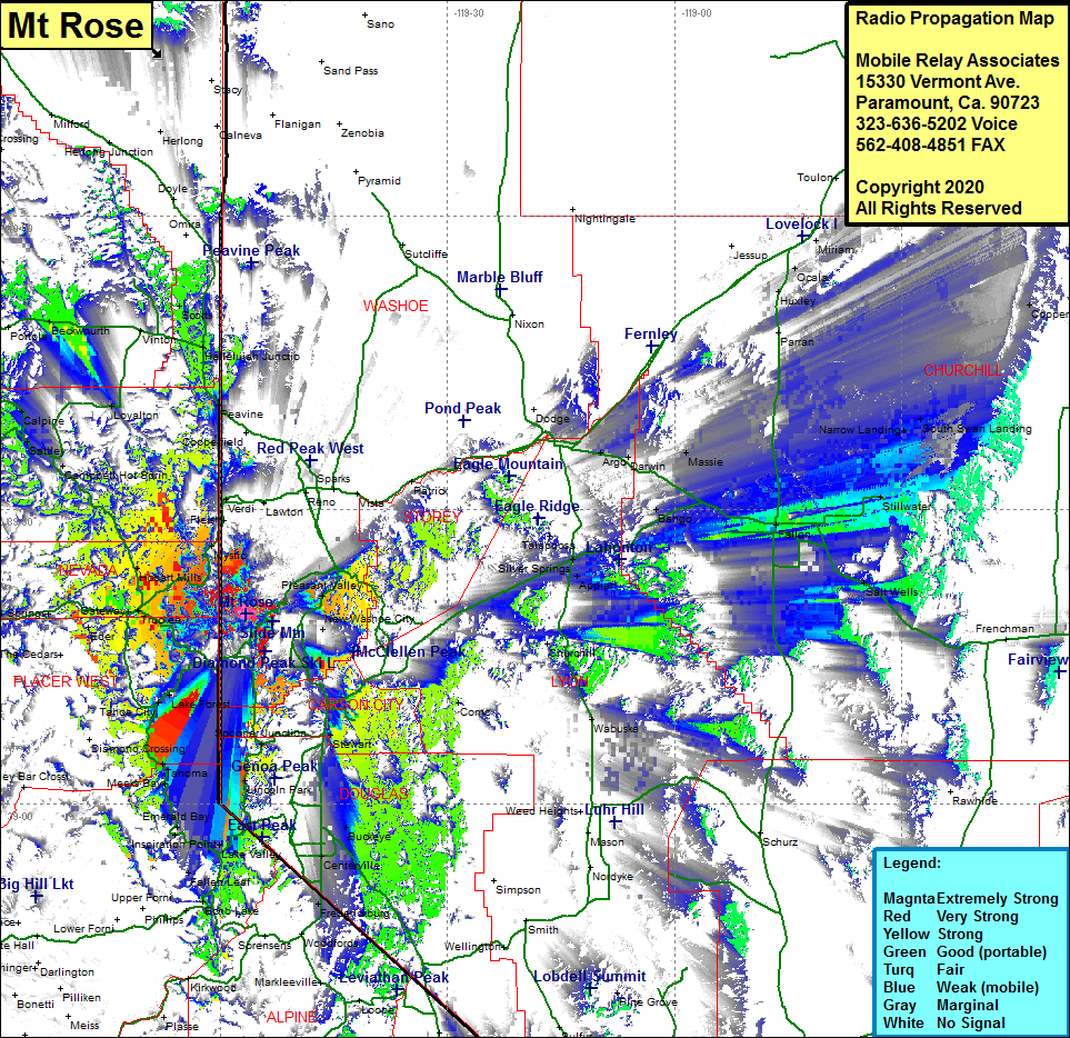 Mt Rose Coverage |
| Latitude: | 039 19 23.7N | 39.3232500 |
| Longitude: | 119 56 38.5W | -119.9440278 |
| Feet | Meters | |
| Ground Elevation: | 10178.0 | 3102.3 |
| HAAT: | 3092.3 | 942.5 |
| City: | Incline Village | |
| County: | Washoe | |
| State: | Nevada |
This is not an MRA Owned Site. For space rental contact the site owner.
Do you own or manage this site? Click Here
Would you like to add a site to the Google Earth Map?? Click Here
Site Coverage: Coverage of the northwest outside portion of the Lake Tahoe mountains that form the basin, mobile coverage of the Lake Tahoe Basin, Truckee, Gateway, Andover, Eder, Polaris, Union Mills, Hirschdale, Boca, Iceland, Floriston, Verdi, Hobart Mills, Cambell Hot Springs, Sierraville, Randolph, Stewart, Red House, Franktown, Pleasant Valley, Washoe City, Buckeye, Minden, Dresslerville, Centerville, Fredrickburg, Payneville, Appian, Silver Springs, Talapoosa, Darwin, Arge, Plazen, Massie