Mt Schader
| Site Name: | Mt Schader | 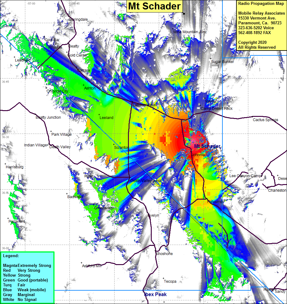 Mt Schader Coverage |
| Latitude: | 036 27 45.2N | 36.4625556 |
| Longitude: | 116 03 35.4W | -116.0598333 |
| Feet | Meters | |
| Ground Elevation: | 4376.0 | 1333.8 |
| HAAT: | 630.2 | 192.1 |
| City: | Johnnie | |
| County: | Nye | |
| State: | Nevada |
This is not an MRA Owned Site. For space rental contact the site owner.
Do you own or manage this site? Click Here
Would you like to add a site to the Google Earth Map?? Click Here
Site Coverage: Coverage of the Pahrump Valley, Pahrump, Johnnie, Leeland, Death Valley Junction, Ashton, Scranton, Camp Desert Rock, Mercury, Mine Mountain Jct, Carrara, Nevada Hwy 160 from Pahrump north to Nevada Hwy 95, Nevada Hwy 95 from Camp Desert Rock west to Carrara, Rhyolite, Springdale