Mt Tenabo
| Site Name: | Mt Tenabo | 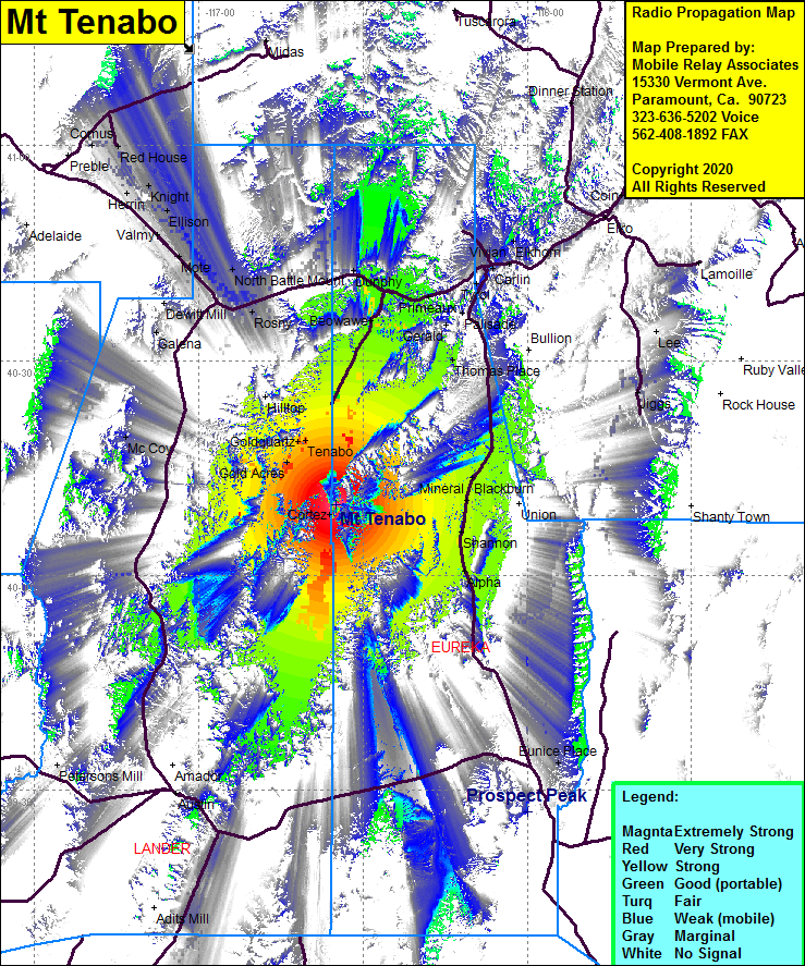 Mt Tenabo Coverage |
| Latitude: | 040 09 47.6N | 40.1632222 |
| Longitude: | 116 34 59.6W | -116.5832222 |
| Feet | Meters | |
| Ground Elevation: | 9173.0 | 2795.9 |
| HAAT: | 3251.0 | 990.9 |
| City: | Eureka | |
| County: | Eureka | |
| State: | Nevada |
This is not an MRA Owned Site. For space rental contact the site owner.
Do you own or manage this site? Click Here
Would you like to add a site to the Google Earth Map?? Click Here
Site Coverage: Coverage of the northern portion of Lander County and Eureka County, Gold Acres, Tenabo, Goldquartz, Beawave, Cortez, Blackburn, Mineral, Shannon, Alpha, Thomas Place, Palisade, Primeaux, Vivian, Moleen, Hunter, Elkhorn, Coin, Osino, Cluro, Haraney, Barth, Dunphy, Rixies, Kampos, Rosny, Battle Mountain, Piute, Mote, Russells, Valmy, Elison, Herrin, Knight, Iron Point, Red House, Comus, Jiggs, Eunice Place, Clan Alpine, portions of Nevada Highway 278 from the intersection of US Highway 50 heading north to Interstate 80 at Carlin