Mustang
| Site Name: | Mustang | 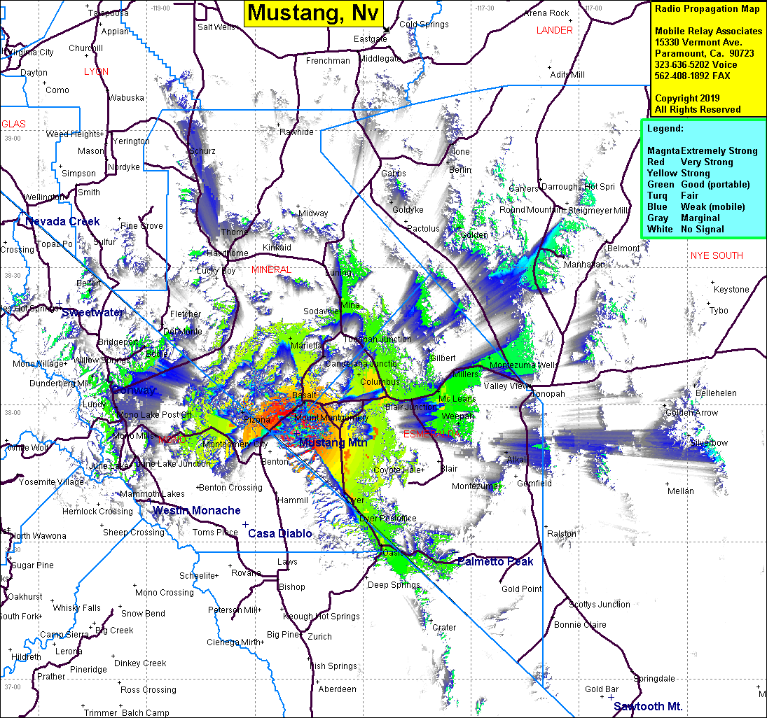 Mustang Coverage |
| Latitude: | 037 53 48.9N | 37.8969167 |
| Longitude: | 118 18 26.1W | -118.3072500 |
| Feet | Meters | |
| Ground Elevation: | 10160.8 | 3097.0 |
| HAAT: | 2587.4 | 788.6 |
| City: | Gold Hit | |
| County: | Esmeralda | |
| State: | Nevada |
This is not an MRA Owned Site. For space rental contact the site owner.
Do you own or manage this site? Click Here
Would you like to add a site to the Google Earth Map?? Click Here
Site Coverage: Coverage of Gold Hit, Basalt, Columbus, Candelaria Jct, Tonopah Jct, Mina, Marietta, The Crossing, Weepah, McLeans, Gilbert, Montezuma Wells