Oasis
| Site Name: | Oasis | 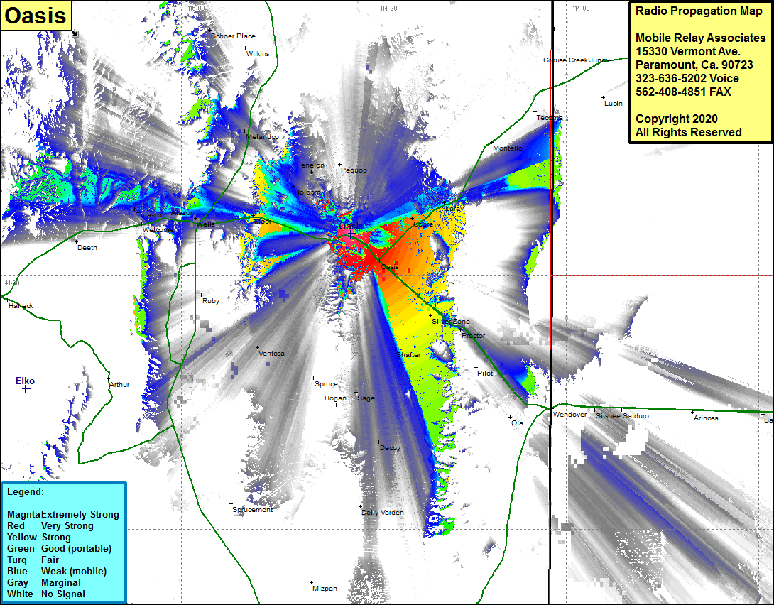 Oasis Coverage |
| Latitude: | 041 04 51.6N | 41.0810000 |
| Longitude: | 114 33 31.6W | -114.5587778 |
| Feet | Meters | |
| Ground Elevation: | 7361.0 | 2243.6 |
| HAAT: | 997.2 | 304.0 |
| City: | Oasis | |
| County: | Elko | |
| State: | Nevada |
This is not an MRA Owned Site. For space rental contact the site owner.
Do you own or manage this site? Click Here
Would you like to add a site to the Google Earth Map?? Click Here
Site Coverage: Coverage of the eastern portion of Elko County, Oasis, Silver Zone, Cobre, Loray, Shafter, Sage, Decoy, Ventosa, Ruby, Moor, Wells, Melandco, Tulasco, Alazon, Deeth, Interstate 80 from about 14 miles west of Wells to Wendover, Nevada Highway 233 heading north from Oasis until just south of Montello, US HIghway 93 heading north from Interstate 80 for about 15 miles