Opal Mountain
| Site Name: | Opal Mountain | 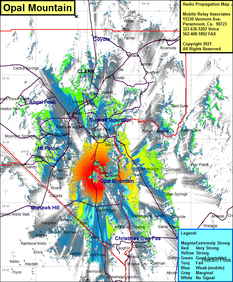 Opal Mountain Coverage |
| Latitude: | 035 42 06.1N | 35.7016944 |
| Longitude: | 114 53 26.1W | -114.8905833 |
| Feet | Meters | |
| Ground Elevation: | 4892.0 | 1491.1 |
| HAAT: | 2086.7 | 636.0 |
| City: | Nelson | |
| County: | Clark | |
| State: | Nevada |
This is not an MRA Owned Site. For space rental contact the site owner.
Do you own or manage this site? Click Here
Would you like to add a site to the Google Earth Map?? Click Here
Site Coverage: Coverage of Nelson, Nelsons Landing, Searchlight, Cal-Nev Ari, Katherine, Mojave Crossing, Dolan Springs, White Hills, Santa Claus, Cerbat, Fort Piute, Lanfair, Barnwell, Juan, Ivanpah, Brant, Jushua, Cima, Moore, Borax, Jean, Goodsprings, Eria, Sloan, Bard, Las Vegas, Henderson, Bonnie Springs, North Las Vegas, Wann, Valley, Lovell, Dike, Apex, Arrolime, Garnet, East Las Vegas, Carver Park, Henderson, Boulder City, Bonelli Landing, Gold Butte