Ophir Peak
| Site Name: | Ophir Peak |  Ophir Peak Coverage |
| Latitude: | 039 19 06.6N | 39.3185000 |
| Longitude: | 119 40 10.2W | -119.6695000 |
| Feet | Meters | |
| Ground Elevation: | 7774.0 | 2369.5 |
| HAAT: | 2362.8 | 720.2 |
| City: | Virginia City | |
| County: | Storey | |
| State: | Nevada |
This is not an MRA Owned Site. For space rental contact the site owner.
Do you own or manage this site? Click Here
Would you like to add a site to the Google Earth Map?? Click Here
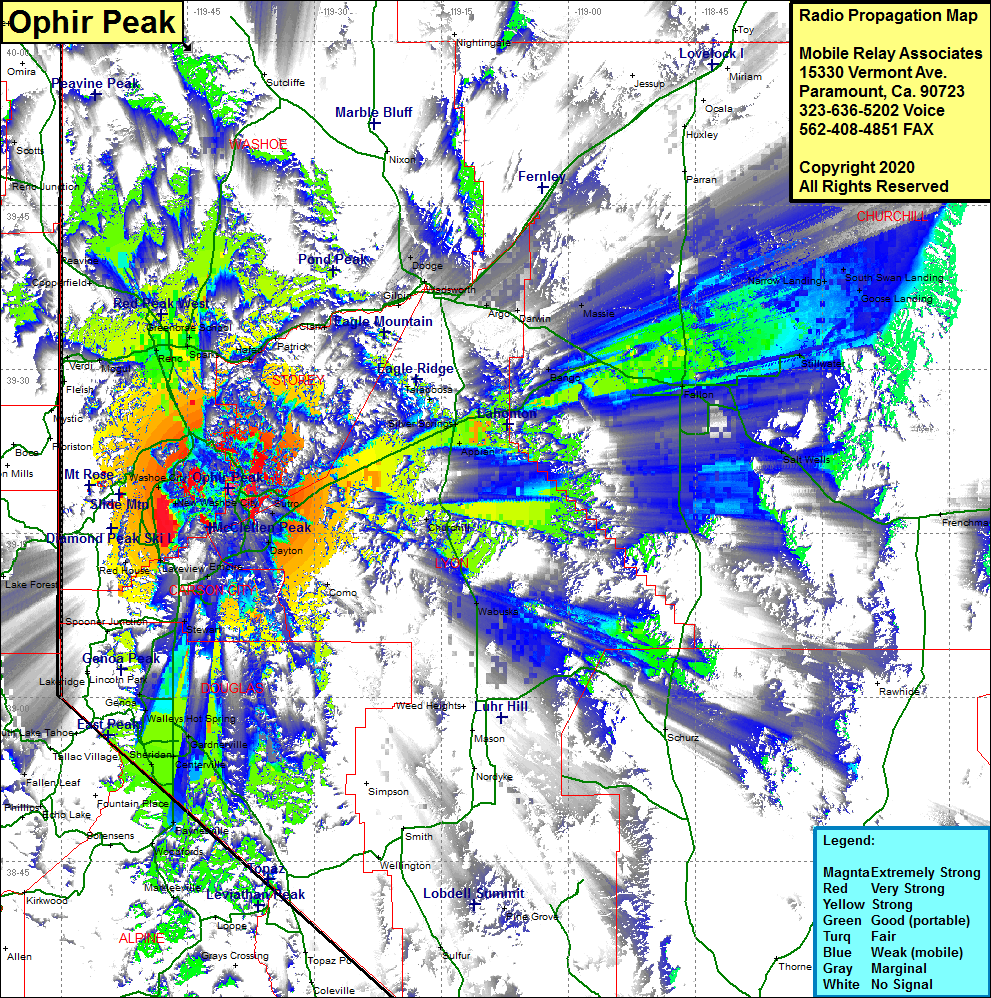
Site Coverage: Coverage of the southern area of Storey County plus portions of Washoe County, Carson City County, Douglas County & Lyon County, Reno, Sparks, Glendale, Vista, Lockwood, Mustang, Halfed, Clark, Black Springs, Martin, Copperfield, Franktown, Lakeview, Carson City, New Empire, Carson Hot Springs, Stewart, Dayton, Sutro, Appian, Silver Springs, Talapoosa, Gold Hill, Virginia City, Bango, Massie, Hazen, Darwin, Argo, Fernley, US Highway 50 heading northeast from Carson City to interstate 50 and past Fallon by about 20 miles, Walleys Hot Springs, Buckeye, Mottsville, Sheridan, Dresslerville, Genoa
