Osgood Mtn
| Site Name: | Osgood Mtn | 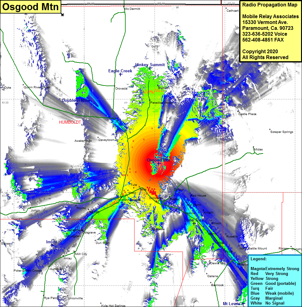 Osgood Mtn Coverage |
| Latitude: | 041 09 17.9N | 41.1549722 |
| Longitude: | 117 28 16.8W | -117.4713333 |
| Feet | Meters | |
| Ground Elevation: | 6322.0 | 1926.9 |
| HAAT: | 1530.4 | 466.5 |
| City: | Winnemucca | |
| County: | Humboldt | |
| State: | Nevada |
This is not an MRA Owned Site. For space rental contact the site owner.
Do you own or manage this site? Click Here
Would you like to add a site to the Google Earth Map?? Click Here
Site Coverage: Coverage of the southeastern portion of Humboldt County, Valmy, Mote, Piute, Battle Mountain, Rosny, Rennox, Russells, Ellison, Knight, Iron Point, Comus, Red House, Comus, Herrin, Preble, Golconda, Adelaide, Bliss, Tule, Weso, Winnemucca, Rose Creek, Raglan, Cosgrove, Tungsten, Mill City, Imlay, Humboldt, Poker Brown Crossing, Pronto, Jungo, Paradise Valley, Bullion, Castle Place