Oxley Peak
| Site Name: | Oxley Peak | 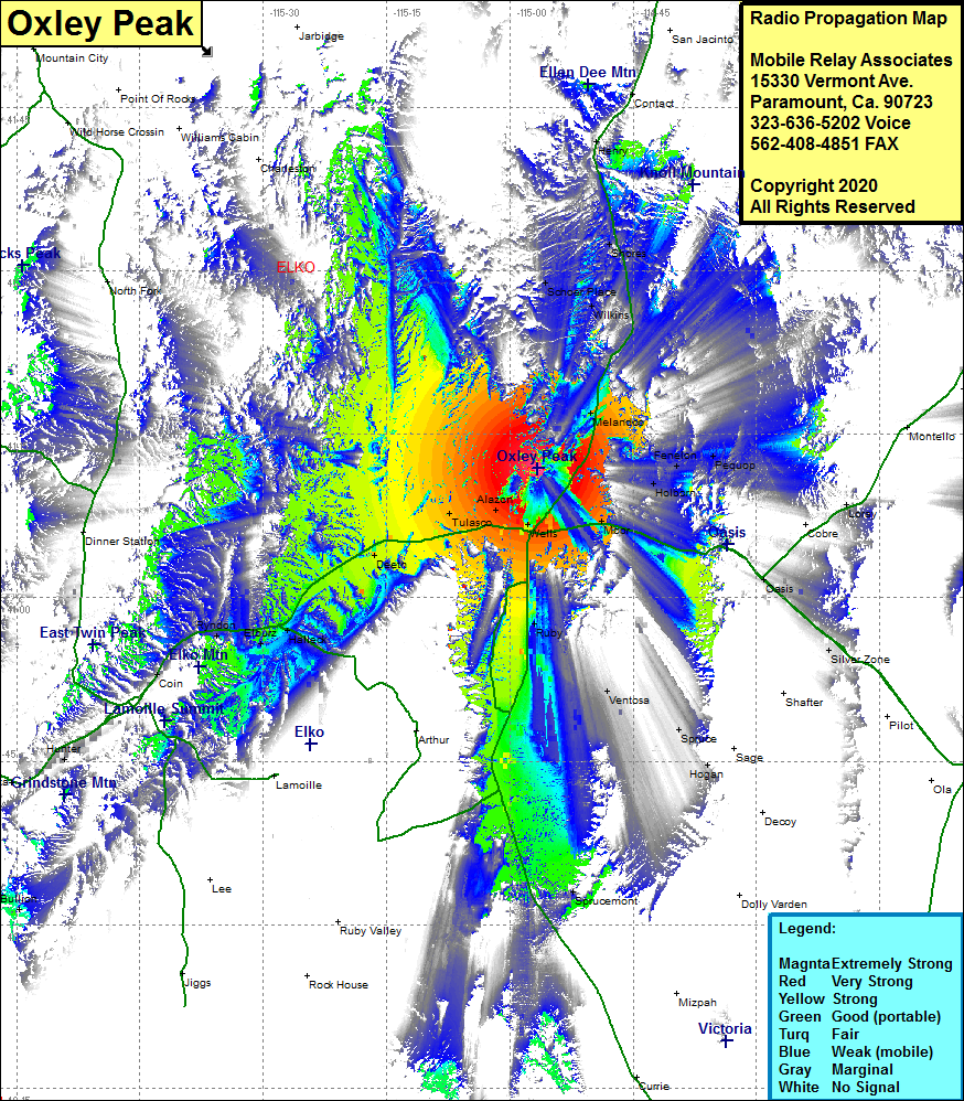 Oxley Peak Coverage |
| Latitude: | 041 11 51.6N | 41.1976667 |
| Longitude: | 114 56 35.4W | -114.9431667 |
| Feet | Meters | |
| Ground Elevation: | 7199.0 | 2194.3 |
| HAAT: | 1259.7 | 384.0 |
| City: | Wells | |
| County: | Elko | |
| State: | Nevada |
This is not an MRA Owned Site. For space rental contact the site owner.
Do you own or manage this site? Click Here
Would you like to add a site to the Google Earth Map?? Click Here
Site Coverage: Coverage of the central eastern portion of Elko County, Wells, Moor, Holborn, Fenelon, Pequop, Melandco, Wilkins, Schoer Place, Shores, Alazon, Tulasco, Welcome, Deeth, Halleck, Elburz, Ryndon, Osino, Coin, Ruby, Ventosa, Oasis, Silver Zone, Henry, Contact, Interstate 80 from Coin in the west to Proctor in the east, US Highway 93 from Spruce Mountain in the south to Contact in the north