Peavine Ridge
| Site Name: | Peavine Ridge | 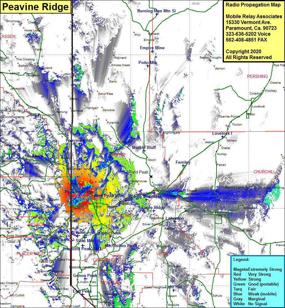 Peavine Ridge Coverage |
| Latitude: | 039 35 12.7N | 39.5868611 |
| Longitude: | 119 55 56.2W | -119.9322778 |
| Feet | Meters | |
| Ground Elevation: | 8267.0 | 2519.8 |
| HAAT: | 2650.3 | 807.8 |
| City: | Anderson | |
| County: | Washoe | |
| State: | Nevada |
This is not an MRA Owned Site. For space rental contact the site owner.
Do you own or manage this site? Click Here
Would you like to add a site to the Google Earth Map?? Click Here
Site Coverage: Coverage of the southern portion of Washoe County, west and south shore of the Lake Tahoe Basin, Spooner Junction, Red House, New Washoe City, Washoe City, Pleasant Valley, Glendale, Sparks, Reno, Greenbrea School, West Reno, Union Mills, Polaris, Truckee, Gateway, Andover, Walleys Hot Spring, Minden, Buckeye, Centerville, Mottsville, Sheridan, Dresslerville, Frederickburg, Paynesville, Youngs Crossing, Como, Appian, Silver Springs, Bango, Plazen, Argo, Massie, Fallon, Parran, Darwin, Fernley, Wadsworth, Dodge, Huxley, Ocala, Scotts, Halleluah Jct, Peavine, Martin, Black Springs