Phoenix Mine
| Site Name: | Phoenix Mine | 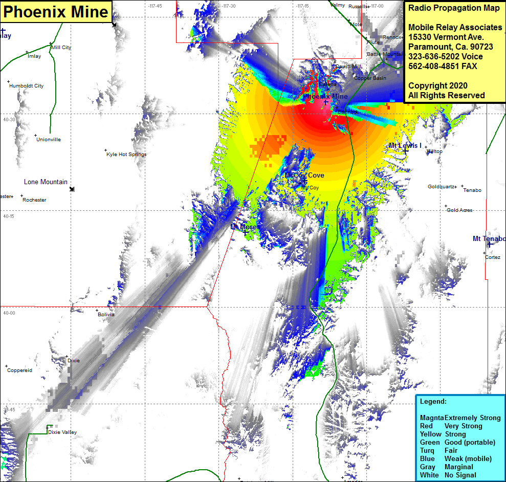 Phoenix Mine Coverage |
| Latitude: | 040 31 49.6N | 40.5304444 |
| Longitude: | 117 08 17.4W | -117.1381667 |
| Feet | Meters | |
| Ground Elevation: | 6198.0 | 1889.2 |
| HAAT: | 919.9 | 280.4 |
| City: | Bannock | |
| County: | Lander | |
| State: | Nevada |
This is not an MRA Owned Site. For space rental contact the site owner.
Do you own or manage this site? Click Here
Would you like to add a site to the Google Earth Map?? Click Here
Site Coverage: Coverage of the northcentral region of Lander County, Bannock, Galena, Buckingham Camp, Dewitt Mill, Battle Mountain, Rosny, Argenta, Kampos, Rixies, McCoy, Nevada Highway 305 from 30 miles north of Austin and heading north to Battle Mountain and Interstate 80 from Battle Mountain heading east for about 15 miles