Pilot Peak
| Site Name: | Pilot Peak | 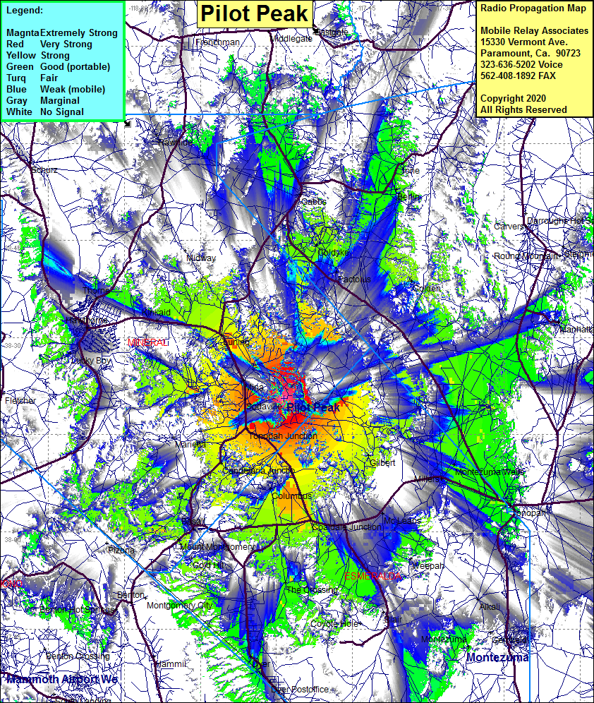 Pilot Peak Coverage |
| Latitude: | 038 20 34.3N | 38.3428611 |
| Longitude: | 117 58 27.4W | -117.9742778 |
| Feet | Meters | |
| Ground Elevation: | 9172.2 | 2795.7 |
| HAAT: | 3226.7 | 983.5 |
| City: | Mina | |
| County: | Mineral | |
| State: | Nevada |
This is not an MRA Owned Site. For space rental contact the site owner.
Do you own or manage this site? Click Here
Would you like to add a site to the Google Earth Map?? Click Here
Site Coverage: Coverage of Tonopah Junction, Tonopah, Mina, Luning, Basalt, Columbus, Coaldale Junction, Mount Montgomery, Gold hit, The Crossing, Weepah, Montezuma Wells, Valley View, Gemfield, Manhattan, Berlin, Ione, Gabbs, Rawhide, Lucky Boy, Hawthorne, Kinkaid