Pine Grove Hill
| Site Name: | Pine Grove Hill | 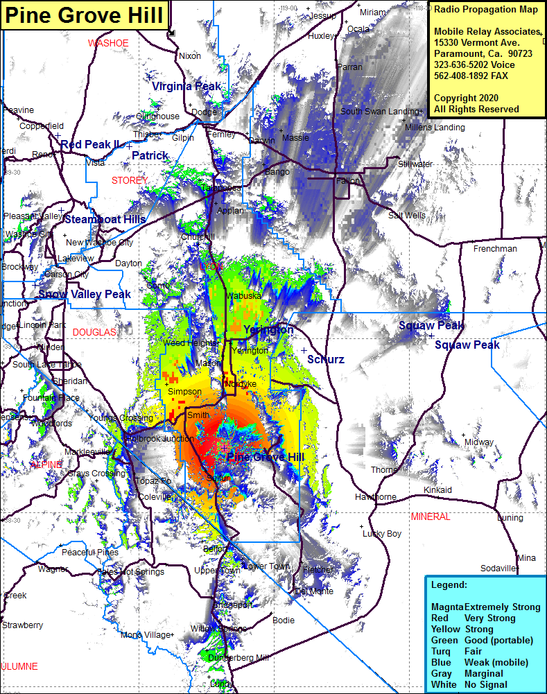 Pine Grove Hill Coverage |
| Latitude: | 038 41 05.2N | 38.6847778 |
| Longitude: | 119 11 08.1W | -119.1855833 |
| Feet | Meters | |
| Ground Elevation: | 8217.0 | 2504.5 |
| HAAT: | 2071.4 | 631.4 |
| City: | Sulfur | |
| County: | Lyon | |
| State: | Nevada |
This is not an MRA Owned Site. For space rental contact the site owner.
Do you own or manage this site? Click Here
Would you like to add a site to the Google Earth Map?? Click Here
Site Coverage: Coverage of the southern portion of Lyon County, Sulfur, Wellington, Smith, Simpson, Nordyke, Mason, Weed Heights, Yerington, Wabuska, Churchill, Appian, Talapoosa, Bango, Massie, Fallon, Parran, Narrow Landing, South Swan Landing, Stillwater, Salt Wells