Pine Nut Mtn
| Site Name: | Pine Nut Mtn | 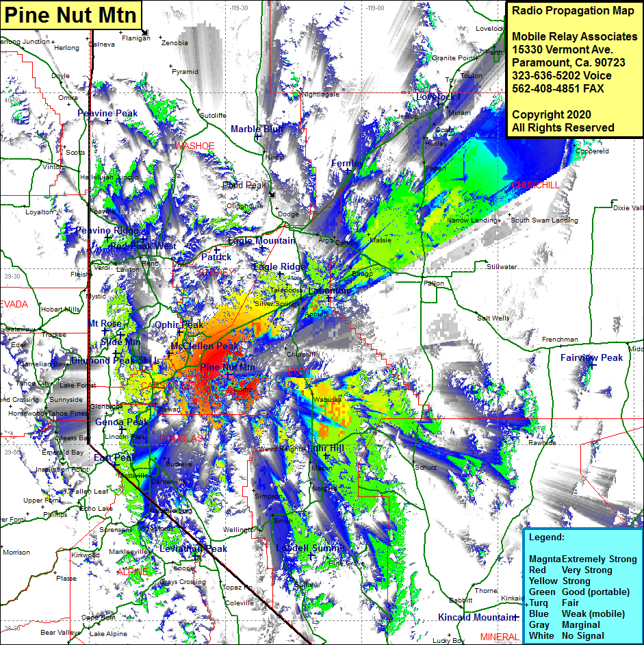 Pine Nut Mtn Coverage |
| Latitude: | 039 11 50.7N | 39.1974167 |
| Longitude: | 119 29 24.1W | -119.4900278 |
| Feet | Meters | |
| Ground Elevation: | 8132.0 | 2478.6 |
| HAAT: | 2524.7 | 769.5 |
| City: | Como | |
| County: | Lyon | |
| State: | Nevada |
This is not an MRA Owned Site. For space rental contact the site owner.
Do you own or manage this site? Click Here
Would you like to add a site to the Google Earth Map?? Click Here
Site Coverage: Coverage of the western portion of Lyon County with coverage spilling over into the adjacent counties, Como, Dayton, Sutro, Silver City, Empire, Lakeview, Carson City, Carson Hot Springs, New Empire, Franktown, Mottsville, Minden, Buckeye, Washoe City, Reno, Sparks, West Reno, Walleys Hot Spring, Sheridan, Centerville, Dresslerville, Simpson, Wellington, Smith, Sulfur, Rockland, Weed Heights, Nordyke, Mason, Yerington, Wabuska, Churchill, Lux, Appian, Silver Springs, Talapoosa, Woodfords, Paynesville, Frederickburg, Spooner Junction, Meeks Bay, Chambers Lodge, Homewood, Idlewild, Tahoe Pines, Camelian Bay, Black Springs, Copperfield, Halfed, Mustang, Dodge, Argo, Darwin, Massie, Bango, Coppereid, Parra, Huxley, Ocala