Poito Peak
| Site Name: | Poito Peak | 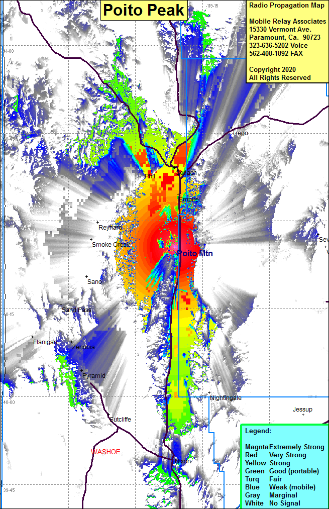 Poito Peak Coverage |
| Latitude: | 040 25 33.5N | 40.4259722 |
| Longitude: | 119 21 05.9W | -119.3516389 |
| Feet | Meters | |
| Ground Elevation: | 5758.9 | 1755.3 |
| HAAT: | 1171.9 | 357.2 |
| City: | Empire | |
| County: | Washoe | |
| State: | Nevada |
This is not an MRA Owned Site. For space rental contact the site owner.
Do you own or manage this site? Click Here
Would you like to add a site to the Google Earth Map?? Click Here
Site Coverage: Coverage of Nevada Hwy 447 from Nixon in the south to Gerlach, Nixon, Gerlach, Phil, Trego