Pond Peak
| Site Name: | Pond Peak | 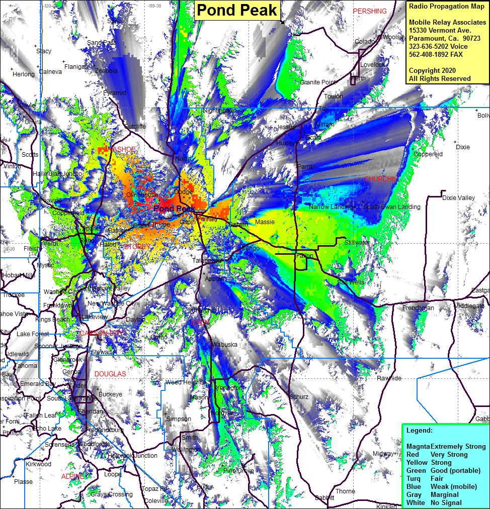 Pond Peak Coverage |
| Latitude: | 039 39 06.0N | 39.6516667 |
| Longitude: | 119 27 51.0W | -119.4641667 |
| Feet | Meters | |
| Ground Elevation: | 8031.5 | 2448.0 |
| HAAT: | 2657.8 | 810.1 |
| City: | Wadsworth | |
| County: | Washoe | |
| State: | Nevada |
This is not an MRA Owned Site. For space rental contact the site owner.
Do you own or manage this site? Click Here
Would you like to add a site to the Google Earth Map?? Click Here
Site Coverage: Coverage of Wadsworth, Thisbe, Gilpin, Argo, Darwin, Massie, Bango, Silver Springs, Fallon, Stillwater, Salt Wells, Narrow Landing, South Swan Landing, Coppereid, Miriam, Ocala, Huxley, Parran, Yerington, Mason, Nordyke, Smith, Simpson, Wabuska, Weed Heights, Reno, Sparks, Panther, Copperfield, Peavine, Vista, Patrick, Clark, Olinghouse, Verdi, Mogul