Rattlesnake Hill
| Site Name: | Rattlesnake Hill | 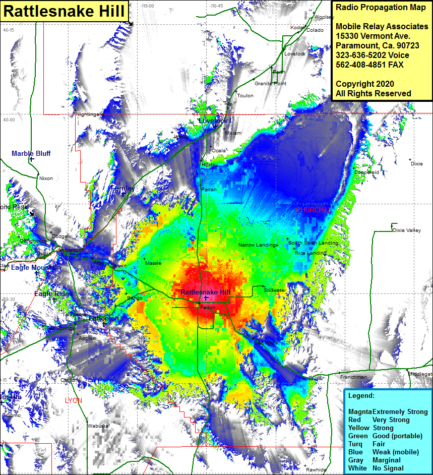 Rattlesnake Hill Coverage |
| Latitude: | 039 29 21.3N | 39.4892500 |
| Longitude: | 118 45 10.4W | -118.7528889 |
| Feet | Meters | |
| Ground Elevation: | 4187.0 | 1276.2 |
| HAAT: | 310.8 | 94.7 |
| City: | Fallon | |
| County: | Churchill | |
| State: | Nevada |
This is not an MRA Owned Site. For space rental contact the site owner.
Do you own or manage this site? Click Here
Would you like to add a site to the Google Earth Map?? Click Here
Site Coverage: Coverage of the western central portion of Churchill County, Fallon, Salt Wells, Massie, Hazen, Bango, Appian, Darwin, Argo, Fernley, Dodge, Olinghouse, Parran, Huxley, Ocala, Millens Landing, Narrow Landing, South Swan Landing, Toy, Toulon, Perth, Coppereid, Millens Landing, Narrow Landing, Goose Landing, South Swan Landing, Frenchman, Silver Springs, Talapoosa