Rio Hotel
| Site Name: | Rio Hotel | 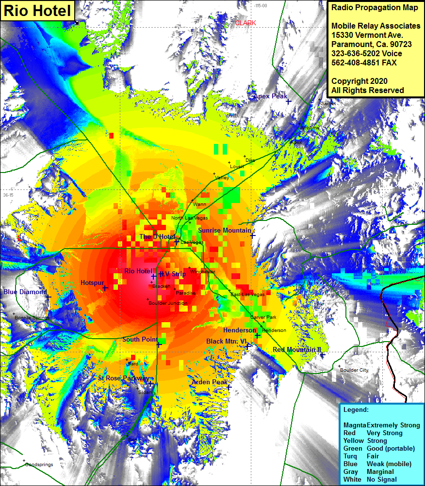 Rio Hotel Coverage |
| Latitude: | 036 06 58.9N | 36.1163611 |
| Longitude: | 115 11 11.8W | -115.1866111 |
| Feet | Meters | |
| Ground Elevation: | 2157.0 | 657.5 |
| HAAT: | 559.5 | 170.5 |
| City: | Las Vegas | |
| County: | Clark | |
| State: | Nevada |
This is not an MRA Owned Site. For space rental contact the site owner.
Do you own or manage this site? Click Here
Would you like to add a site to the Google Earth Map?? Click Here
Site Coverage: Coverage of the Las Vegas area of Clark County, Las Vegas Strip, Bracken, Boulder Jct, Paradise, Winchester, East Las Vegas, Carver Park, Henderson, North Las Vegas, Wann, valley, Lovell, Dike, Apex, Arrowlime, Blue Diamond, Bonnie Springs, Sloan, Interstate 15 from Jean heading north through Las Vegas and continuing north to Nevada Highway 156 (Lee Canyon Road)