South Point
| Site Name: | South Point | 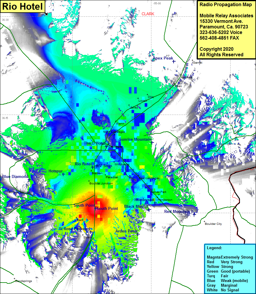 South Point Coverage |
| Latitude: | 036 00 41.4N | 36.0115000 |
| Longitude: | 115 10 34.0W | -115.1761111 |
| Feet | Meters | |
| Ground Elevation: | 2269.0 | 691.6 |
| HAAT: | 39.2 | 11.9 |
| City: | Las Vegas | |
| County: | Clark | |
| State: | Nevada |
This is not an MRA Owned Site. For space rental contact the site owner.
Do you own or manage this site? Click Here
Would you like to add a site to the Google Earth Map?? Click Here
Site Coverage: Coverage of the Las Vegas area of Clark County, Las Vegas Strip, Bracken, Boulder Jct, Paradise, Winchester, East Las Vegas, Carver Park, Henderson, North Las Vegas, Wann, Valley, Lovell, Dike, Apex, Arrowlime, Blue Diamond, Bonnie Springs, Bard, Erie, Las Vegas Strip, Interstate 15 from Erie to Apex, US 95 from Henderson to Nevada Hightway 157 (Kyle Canyon Rd)