Steamboat Hills
| Site Name: | Steamboat Hills | 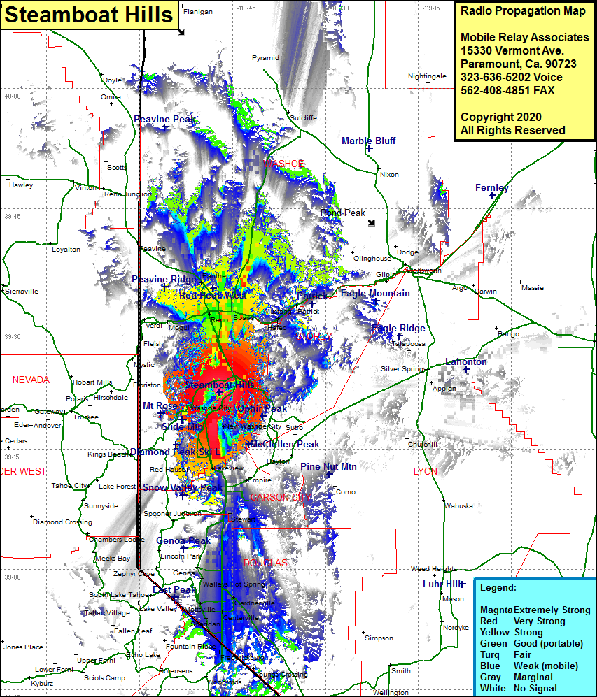 Steamboat Hills Coverage |
| Latitude: | 039 22 03.5N | 39.3676389 |
| Longitude: | 119 47 11.4W | -119.7865000 |
| Feet | Meters | |
| Ground Elevation: | 6079.0 | 1852.9 |
| HAAT: | 145.3 | 44.3 |
| City: | Pleasant Valley | |
| County: | Washoe | |
| State: | Nevada |
This is not an MRA Owned Site. For space rental contact the site owner.
Do you own or manage this site? Click Here
Would you like to add a site to the Google Earth Map?? Click Here
Site Coverage: Coverage of the southern portion of Washoe County, portions of Carson City County and Douglas County, Reno, Sparks, West Reno, Greenbrae School, Raleigh Heights, Black Springs, Martin, Vista, Hafed, Mustang, Washoe City, New Washoe City, Franktown, Lakeview, Carson Hot Springs, Carson City, Stewart, Genoa, Walleys Hot Spring, Buckeye, Mottsville, Sheridan, Centerville, Dresslerville, Frederickburg