Telegraph Peak
| Site Name: | Telegraph Peak | 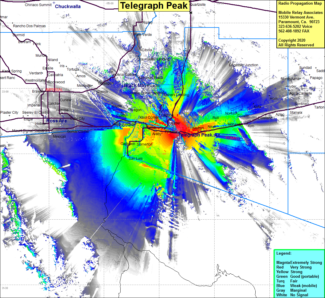 Telegraph Peak Coverage |
| Latitude: | 032 40 23.7N | 32.6732500 |
| Longitude: | 114 20 13.8W | -114.3371667 |
| Feet | Meters | |
| Ground Elevation: | 1648.0 | 502.3 |
| HAAT: | 1272.0 | 387.7 |
| City: | Ligurta | |
| County: | Yuma | |
| State: | Arizona |
This is not an MRA Owned Site. For space rental contact the site owner.
Do you own or manage this site? Click Here
Would you like to add a site to the Google Earth Map?? Click Here
Site Coverage: Coverage of Somerton, San Luis, Stream, Andrede, Steam, Araz Junction, Winterhaven, Yuma, Ross Corner, Bard, Araby, Kool Corner, Fortuna, Dunes, Ogliby, Cactus, Clyde, Ruthglen, Glamis, Bonds Corner, Date City, Sandia, Rico, Calexico, Araby, Ligurta, Dome, Welton, Asher, Noah, tacna, Colfred, Roll, Tyson, Norton, Grove, Owl, Mohawk, Kofa, Palomas, Horn, Stoval, Kim, Castle Dome Landing, Fishers Landing, US95 from Yuma and north to the Yuma County Line