Tempiute
| Site Name: | Tempiute | 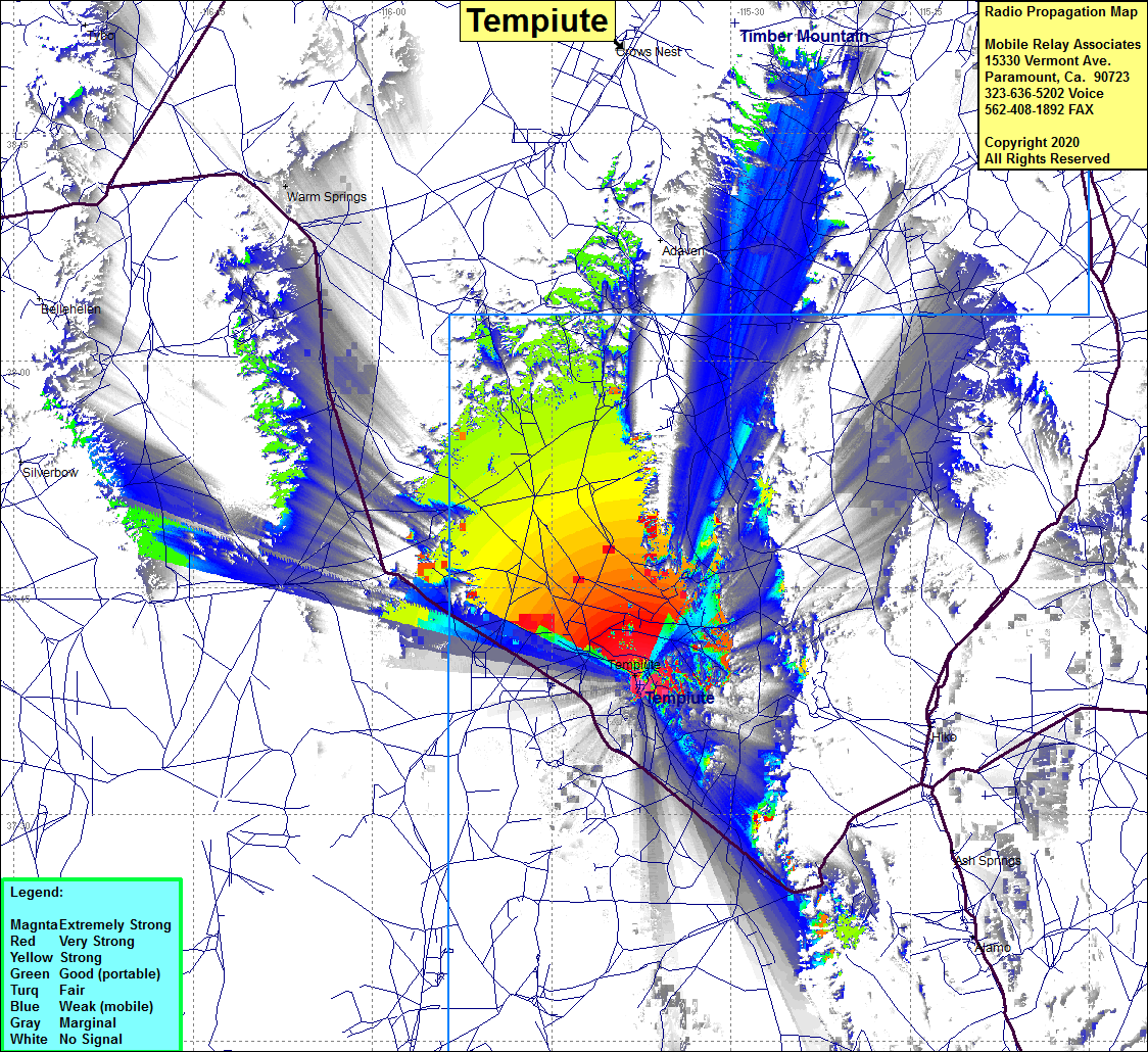 Tempiute Coverage |
| Latitude: | 037 38 35.4N | 37.6431667 |
| Longitude: | 115 37 40.8W | -115.6280000 |
| Feet | Meters | |
| Ground Elevation: | 6848.8 | 2087.5 |
| HAAT: | 1232.5 | 375.7 |
| City: | Timpiute | |
| County: | Lincoln | |
| State: | Nevada |
This is not an MRA Owned Site. For space rental contact the site owner.
Do you own or manage this site? Click Here
Would you like to add a site to the Google Earth Map?? Click Here
Site Coverage: Coverage of Central Nevada in Lincoln County near Area 51, Tempiute, Warm Springs, Ruppes Place, portions of Highway 375 north to Warm Springs and south past Tempiute to where the highway turns east to go through the mountains to head towards Crystal Springs and Highway 93 and Highway 318