Timber Mtn I
| Site Name: | Timber Mtn I | 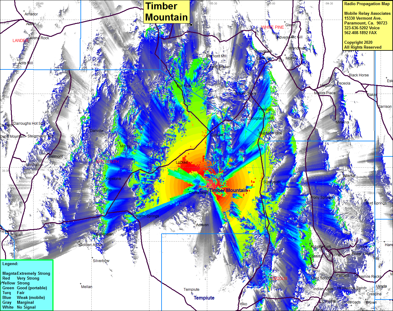 Timber Mtn I Coverage |
| Latitude: | 038 22 18.8N | 38.3718889 |
| Longitude: | 115 29 41.1W | -115.4947500 |
| Feet | Meters | |
| Ground Elevation: | 9133.9 | 2784.0 |
| HAAT: | 2574.9 | 784.8 |
| City: | Current Creek | |
| County: | Nye | |
| State: | Nevada |
This is not an MRA Owned Site. For space rental contact the site owner.
Do you own or manage this site? Click Here
Would you like to add a site to the Google Earth Map?? Click Here
Site Coverage: Coverage of Current, Crows Nest, Lockes, Ruepes Place, Lund, Preston, Douglas, Willow Grove, Abbotts Fork, Caselton, Foche, Sunnyside, Pony Springs, Atlanta, Minerva, Osceola, Preston, Douglas Lund, Willow Grove, Shermantown, Belmont Mill, Bull Fork, Tybo, Keystone, Morey, Danville, Highway 318 from north of Hiko to US6, US Highway 6 from north of Highway 318 to HIghway 93