Tokop Peak
| Site Name: | Tokop Peak | 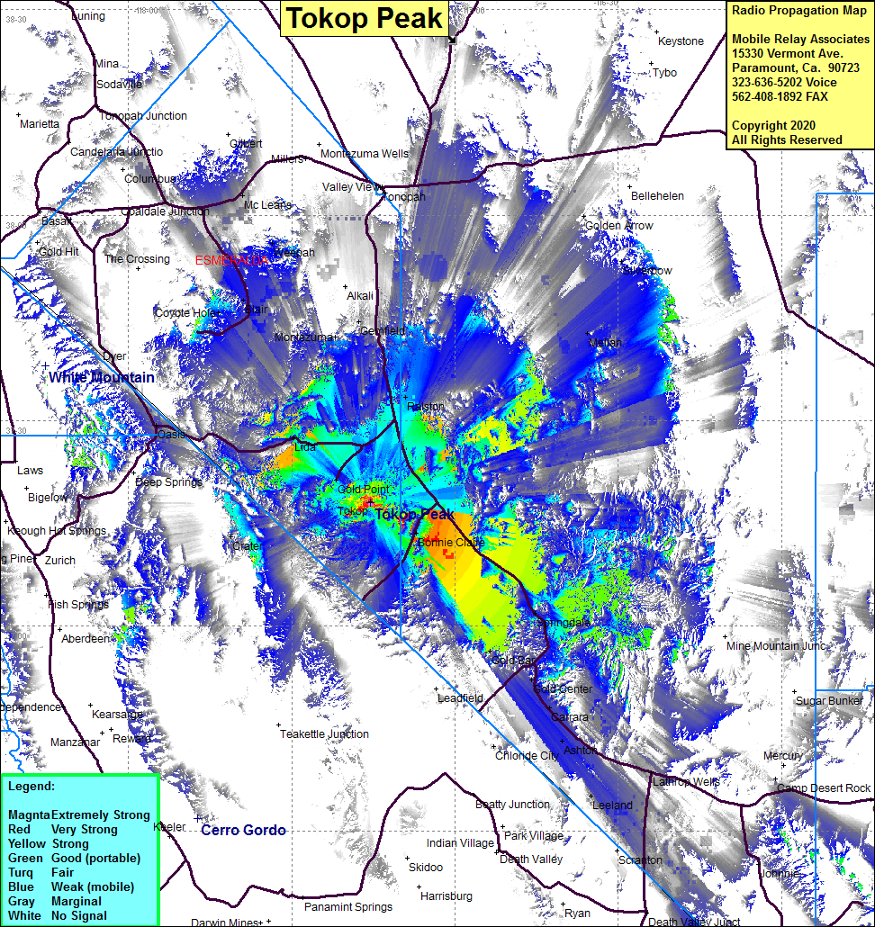 Tokop Peak Coverage |
| Latitude: | 037 17 59.9N | 37.2999722 |
| Longitude: | 117 15 38.3W | -117.2606389 |
| Feet | Meters | |
| Ground Elevation: | 7004.6 | 2135.0 |
| HAAT: | 1426.8 | 434.9 |
| City: | Scottys Junction | |
| County: | Esmeralda | |
| State: | Nevada |
This is not an MRA Owned Site. For space rental contact the site owner.
Do you own or manage this site? Click Here
Would you like to add a site to the Google Earth Map?? Click Here
Site Coverage: Coverage of Scottys Junction, Gold Point, Bonnie Claire, Springdale, Gold Bar, Gold Center, Carrara, Ashton, Lathrop Wells, Leeland, Crater, Lida, Ralston, Gemfield, Weepah, Mc Leans, The Crossing, Dyer Post Office, Dyer, Highway 93 from Lathrop Wells to Valley View, Tokop