Toms Hill
| Site Name: | Toms Hill | 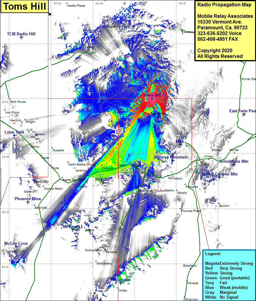 Toms Hill Coverage |
| Latitude: | 041 00 01.4N | 41.0003889 |
| Longitude: | 116 23 38.6W | -116.3940556 |
| Feet | Meters | |
| Ground Elevation: | 5717.0 | 1742.5 |
| HAAT: | -10.8 | -3.3 |
| City: | Tuscarora | |
| County: | Elko | |
| State: | Nevada |
This is not an MRA Owned Site. For space rental contact the site owner.
Do you own or manage this site? Click Here
Would you like to add a site to the Google Earth Map?? Click Here
Site Coverage: Coverage of the southwestern portion of Elko County, the northwestern portion of Eureka County and the northeastern portion of Lander County, Scraper Springs, Midas, Dunphy, Rixies, Mosel, Agrenta, Kampos, Rosny, Tenabo, Beowave, Valmy, Ellison