Topaz
| Site Name: | Topaz | 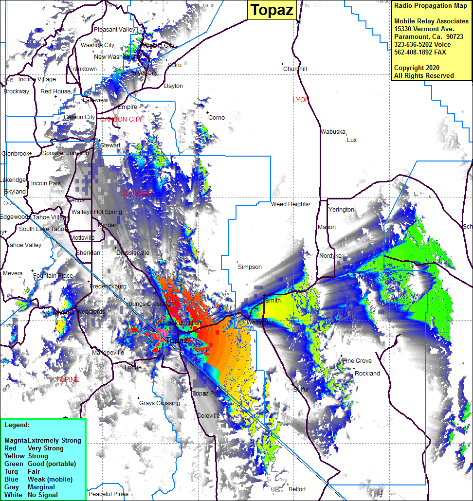 Topaz Coverage |
| Latitude: | 038 43 22.5N | 38.7229167 |
| Longitude: | 119 35 29.6W | -119.5915556 |
| Feet | Meters | |
| Ground Elevation: | 7386.8 | 2251.5 |
| HAAT: | 966.1 | 294.5 |
| City: | Holbrook Jct | |
| County: | Douglas | |
| State: | Nevada |
This is not an MRA Owned Site. For space rental contact the site owner.
Do you own or manage this site? Click Here
Would you like to add a site to the Google Earth Map?? Click Here
Site Coverage: Coverage of Topaz Lake, Grays Crossing, Holbrook Jct, Wellington, Topaz PO, Smith, Sulfur, Coleville, Dressleville, Minden, Woodlands, Empire, Buckeye, Paynesville, Highway 208 from US395 past the junction of Highway 208 and Highway 339 to where Highway 208 turns north towards Yerington