Toulon Peak
| Site Name: | Toulon Peak | 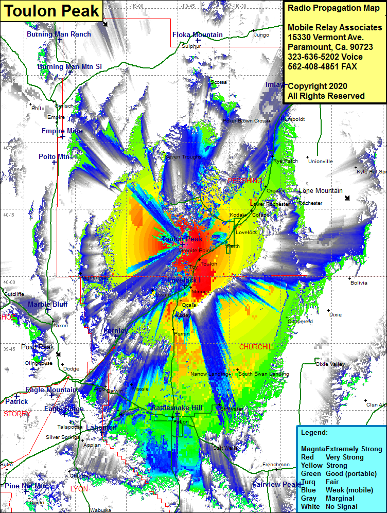 Toulon Peak Coverage |
| Latitude: | 040 07 04.9N | 40.1180278 |
| Longitude: | 118 43 39.2W | -118.7275556 |
| Feet | Meters | |
| Ground Elevation: | 6820.0 | 2078.7 |
| HAAT: | 2059.1 | 627.6 |
| City: | Toulon | |
| County: | Pershing | |
| State: | Nevada |
This is not an MRA Owned Site. For space rental contact the site owner.
Do you own or manage this site? Click Here
Would you like to add a site to the Google Earth Map?? Click Here
Site Coverage: Coverage of the southern portion of Pershing County and the northern portion of Churchill County, Toulon, Toy, Miriam, Ocala, Parran, Narrow Landing, Peers Landing, South Swan Landing, Coppereid, Stillwater. Salt Water, Fallon, Bango, Massie, Darwin, Argo, Granite Point, Perth, Lovelock, Kodak, Oreana, Woolsey, Rochester, Rye Patch, Humboldt, Imlay, Mill City, Cosgrove, Raglan, Vernon, Seven Troughs, Nightingale, Nixon