Treasure Hill
| Site Name: | Treasure Hill |  Treasure Hill Coverage |
| Latitude: | 037 55 18.7N | 37.9218611 |
| Longitude: | 114 26 59.4W | -114.4498333 |
| Feet | Meters | |
| Ground Elevation: | 6825.0 | 2080.3 |
| HAAT: | 984.5 | 300.1 |
| City: | Atlanta | |
| County: | Lincoln | |
| State: | Nevada |
This is not an MRA Owned Site. For space rental contact the site owner.
Do you own or manage this site? Click Here
Would you like to add a site to the Google Earth Map?? Click Here
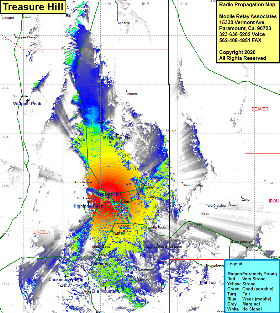
Site Coverage: Coverage of the northeastern portion of Lincoln County, Atlanta, Pioche, Mendha, Abbotts Fork, Big Trees, Caselton, Rose Valley, Ursine, Fay, Panaca, Cold Spring, Uvada, Ninemile Rocks, Indian Cove, Caliente, Eccles, Etna, Crossroads, Acoma, Brown, Crestline, Horseshoe Bend, Mud Springs, Pony Springs, Modena, Nevada Highway 319 from Caliente heading north to 35 miles past Malloy Springs Rd and Nevada Highway 319 heading east from Panaca for 16 miles
