Trident Peak
| Site Name: | Trident Peak | 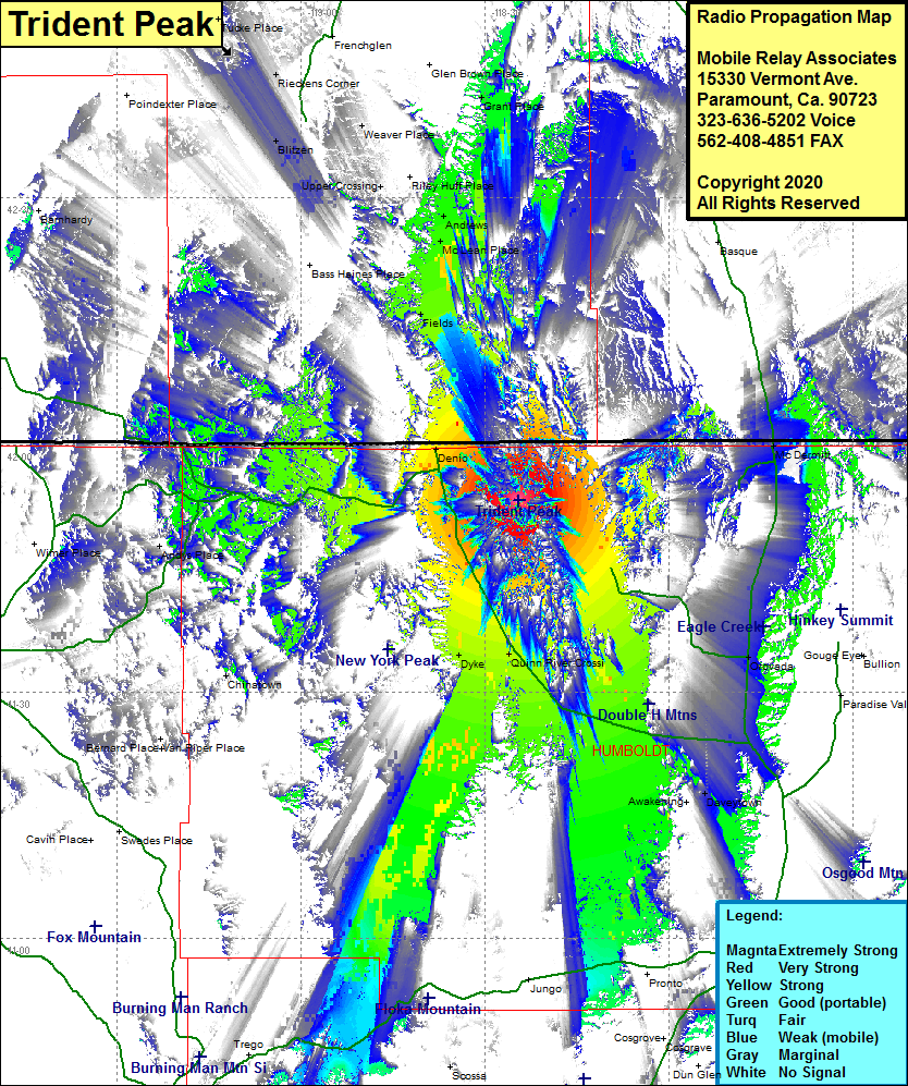 Trident Peak Coverage |
| Latitude: | 041 53 11.0N | 41.8863889 |
| Longitude: | 118 24 35.5W | -118.4098611 |
| Feet | Meters | |
| Ground Elevation: | 8487.0 | 2586.8 |
| HAAT: | 2854.5 | 870.1 |
| City: | Denio | |
| County: | Humboldt | |
| State: | Nevada |
This is not an MRA Owned Site. For space rental contact the site owner.
Do you own or manage this site? Click Here
Would you like to add a site to the Google Earth Map?? Click Here
Site Coverage: Coverage of the northcentral portion of Humboldt County, Denio, Denio Jct, Dyke, Quinn River Crossing, Sulphur, Raglan, Rose Creek, Cosgrave, Daveytown, Orovada, McDermitt, Burns Junction, Weaver Place, Upper Crossing, Andrews, McLean Place, Fields, Poe Place, Chinatown