Warm Springs Mtn
| Site Name: | Warm Springs Mtn | 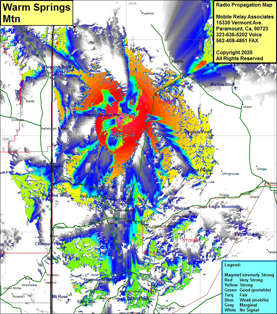 Warm Springs Mtn Coverage |
| Latitude: | 039 47 43.1N | 39.7953056 |
| Longitude: | 119 46 01.5W | -119.7670833 |
| Feet | Meters | |
| Ground Elevation: | 6024.0 | 1836.1 |
| HAAT: | 927.8 | 282.8 |
| City: | Copperfield | |
| County: | Washoe | |
| State: | Nevada |
This is not an MRA Owned Site. For space rental contact the site owner.
Do you own or manage this site? Click Here
Would you like to add a site to the Google Earth Map?? Click Here
Site Coverage: Coverage of the southern portion of Washoe County, Peavine, Copperfield, Black Springs, Reno, West Reno, Greenbrae School, Sparks, Vista, Lockwood, Lakeview, Omira, Doyle, Herlong Jct, Calneva