West Twin Peak
| Site Name: | West Twin Peak | 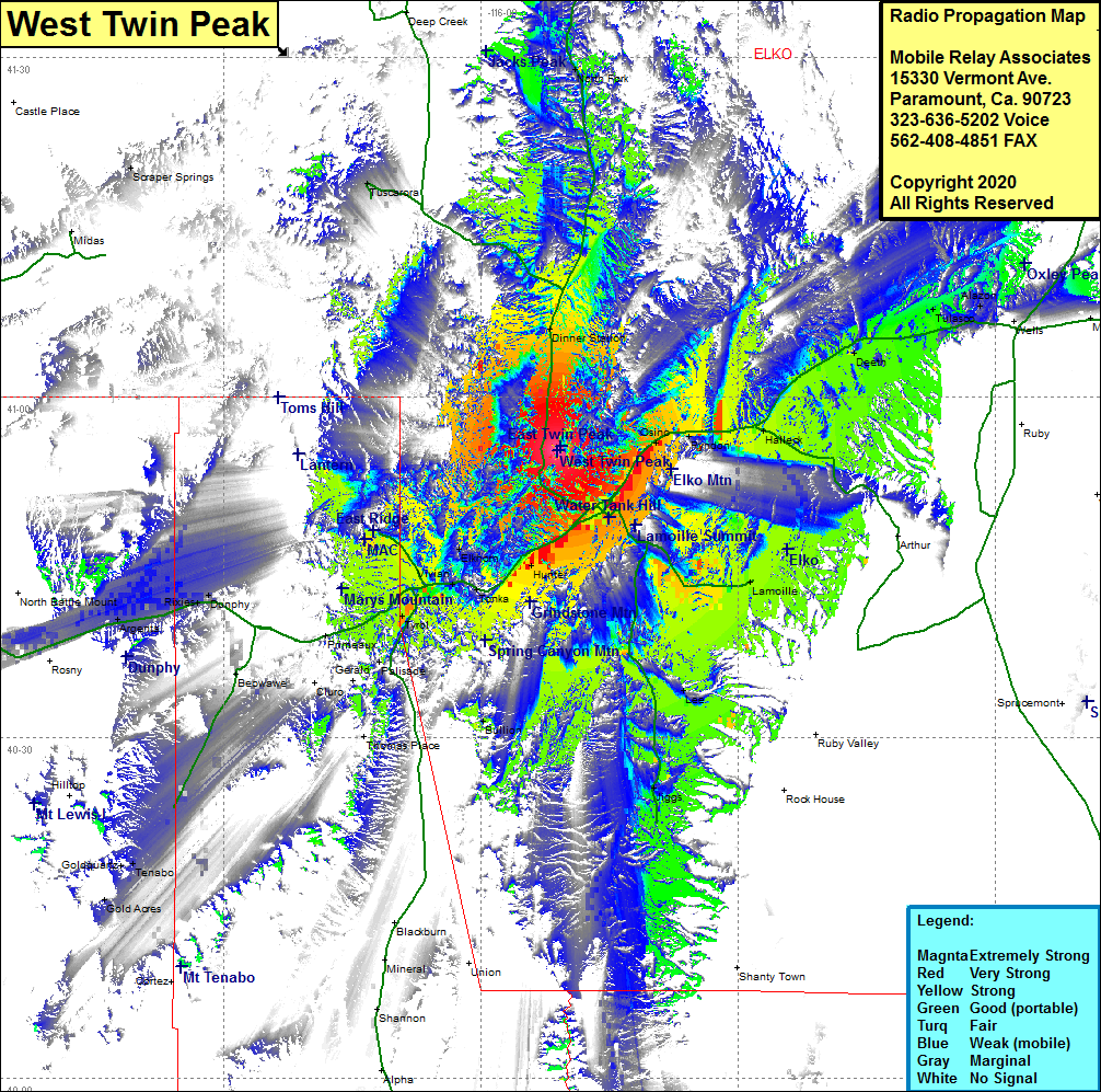 West Twin Peak Coverage |
| Latitude: | 040 55 19.1N | 40.9219722 |
| Longitude: | 115 50 59.8W | -115.8499444 |
| Feet | Meters | |
| Ground Elevation: | 7471.0 | 2277.2 |
| HAAT: | 1530.8 | 466.6 |
| City: | Elko | |
| County: | Elko | |
| State: | Nevada |
This is not an MRA Owned Site. For space rental contact the site owner.
Do you own or manage this site? Click Here
Would you like to add a site to the Google Earth Map?? Click Here
Site Coverage: Coverage of the central portion of Elko County, Elko, Osino, Ryndon, Halleck, Deeth, Welcome, Tulasco, Alazon, Dinner Station, Lamoile, Lee, Jiggs, Hunter, Tonka, Elkhorn, Carlin, Vivian, Tyrol, Palisade, Primeaux, Gerald, Cluro, Beowave, Blackburn, Tenabo, Gold Acres, Dunphy, Rixies, Argenta, Kampos, Rennox, Battle Mountain, Scraper Springs, Tuscarora, North Fork, Interstate 80 from 12 miles west of Carlin, to 3 miles west of Wells, Nevada Highway 225 heading north from Elko to 15 miles south of Mountain City