Whipple Peak
| Site Name: | Whipple Peak | 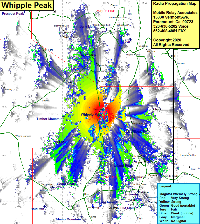 Whipple Peak Coverage |
| Latitude: | 038 24 59.8N | 38.4166111 |
| Longitude: | 114 58 34.0W | -114.9761111 |
| Feet | Meters | |
| Ground Elevation: | 8826.0 | 2690.2 |
| HAAT: | 2948.2 | 898.6 |
| City: | Sunnyside | |
| County: | Lincoln | |
| State: | Nevada |
This is not an MRA Owned Site. For space rental contact the site owner.
Do you own or manage this site? Click Here
Would you like to add a site to the Google Earth Map?? Click Here
Site Coverage: Coverage of the northeastern portion of Lincoln County, Atlanta, Sunnyside, Ruppes Place, Douglas, Lund, Preston, Willow Grove, Tybo, Abbotts Fork, Pony Springs, Nevada Highway 318 from 10 miles north of Hiko heading north to US Highway 6 and US Highway 93 from 9 miles north of Pioche heading north with some gaps to the Lincoln County line