White Hill
| Site Name: | White Hill | 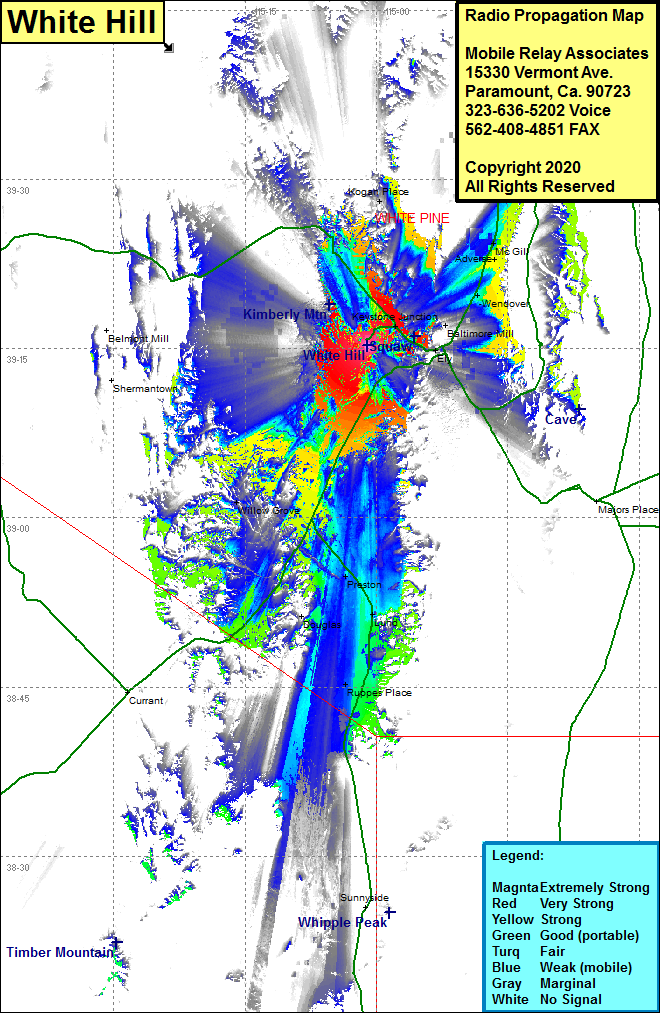 White Hill Coverage |
| Latitude: | 039 15 16.8N | 39.2546667 |
| Longitude: | 115 01 01.5W | -115.0170833 |
| Feet | Meters | |
| Ground Elevation: | 7475.0 | 2278.4 |
| HAAT: | 446.8 | 136.2 |
| City: | Ely | |
| County: | White Pine | |
| State: | Nevada |
This is not an MRA Owned Site. For space rental contact the site owner.
Do you own or manage this site? Click Here
Would you like to add a site to the Google Earth Map?? Click Here
Site Coverage: Coverage of the southcentral portion of White Pine County, Ely, Willow Grove, Preston, Kogan Place, McGill Junction, Adverse, McGill, Wendover, Steptoe, Keystone Junction, Mosier, Preston, Lund, Ruppes Place, Douglas, US Highway 6 from the southwestern Ely County line northwest to Ely, US Highway 50 starting 35 miles west of Ely to US Highway 93