Winnemucca Lamda
| Site Name: | Winnemucca Lamda | 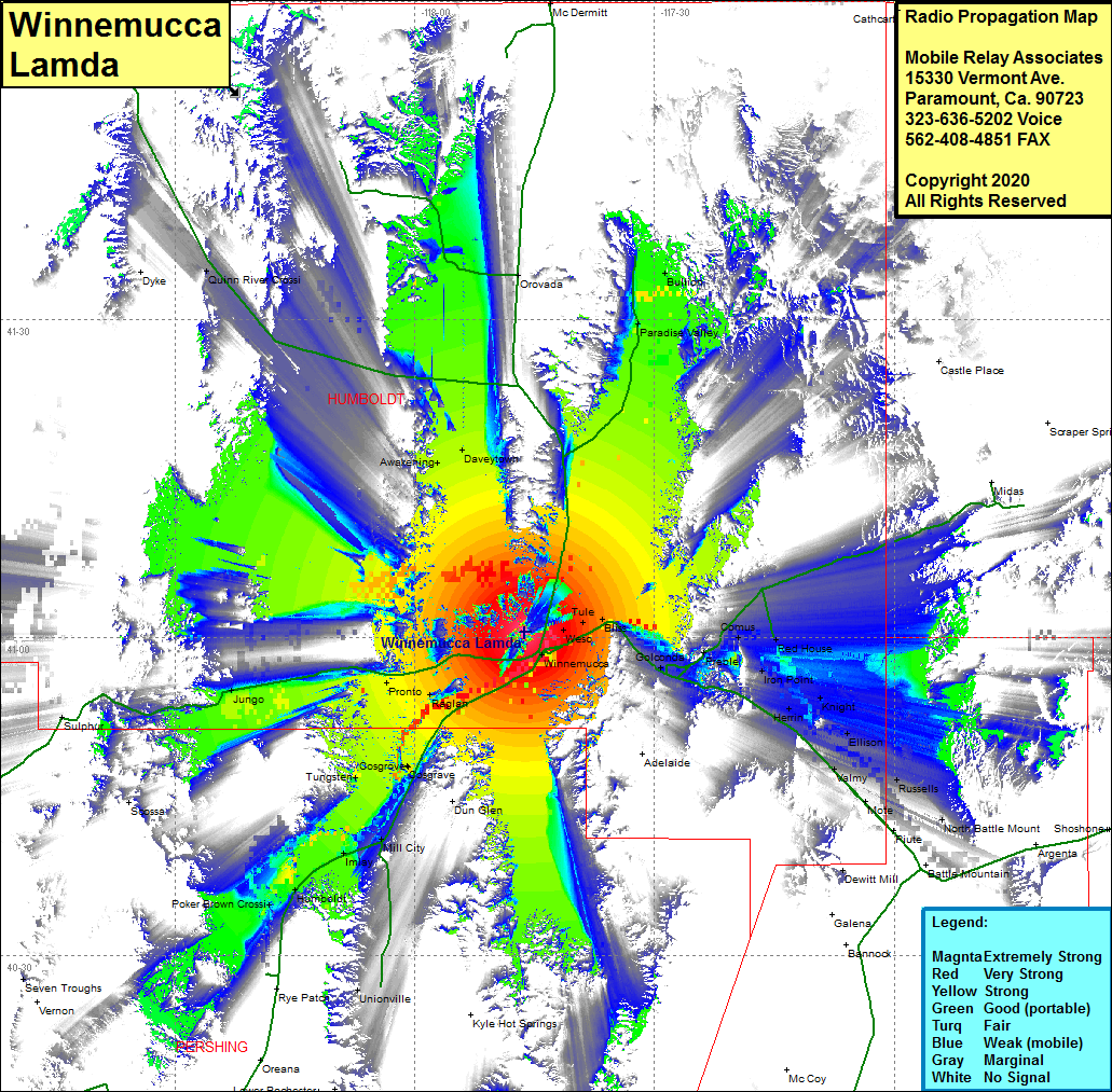 Winnemucca Lamda Coverage |
| Latitude: | 041 00 30.0N | 41.0083333 |
| Longitude: | 117 46 11.7W | -117.7699167 |
| Feet | Meters | |
| Ground Elevation: | 6716.0 | 2047.0 |
| HAAT: | 2154.0 | 656.5 |
| City: | Winnemucca | |
| County: | Humboldt | |
| State: | Nevada |
This is not an MRA Owned Site. For space rental contact the site owner.
Do you own or manage this site? Click Here
Would you like to add a site to the Google Earth Map?? Click Here
Site Coverage: Coverage of the southcentral portion of Humboldt County, Winnemucca, Weso, Tule, Bliss, Golconda, Preble, Comus, Red House, Iron Point, Knight, Herrin, Ellison, Valmy, Mote, North Battle Mountain, Russells, Ellison, Jenkins, Rose Creek, Cosgrove, Cosgrave, Tungsten, Mill City, Imlay, Humboldt, Unionville, Tungston, Sulphur, Jungo, Pronto, Awakening, Daveytown, Quinn River Crossing, Orovada, Paradise Valley, Bullion, Interstate 80 from 15 miles south of the intersection of Nevada Highway 400 to 10 miles west of Batle Mountain