Winnemucca Mtn
| Site Name: | Winnemucca Mtn | 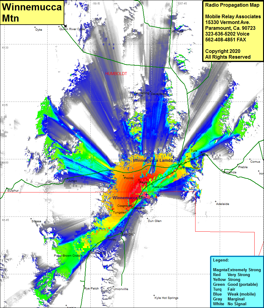 Winnemucca Mtn Coverage |
| Latitude: | 040 50 41.1N | 40.8447500 |
| Longitude: | 117 55 29.9W | -117.9249722 |
| Feet | Meters | |
| Ground Elevation: | 5178.0 | 1578.3 |
| HAAT: | 555.8 | 169.4 |
| City: | Cosgrave | |
| County: | Pershing | |
| State: | Nevada |
This is not an MRA Owned Site. For space rental contact the site owner.
Do you own or manage this site? Click Here
Would you like to add a site to the Google Earth Map?? Click Here
Site Coverage: Coverage of the northcentral portion of Pershing County and the southcentral portion of Humboldt County, Winnemucca, Weso, Tule, Bliss, Jungo, Pronto, Raglan, Rose Creek, Cosgrove, Cosgrave, Tungsten, Dun Glen, Mill City, Imlay, Humboldt, Poker Brown Crossing, Unionville, Awakening, Daveytown, Paradise Valley, Interstate 80 from Humboldt heading northeast to Winnemucca and Nevada Highway 49 from 40 miles west of Winnemucca to Winemucca