Yerington
| Site Name: | Yerington | 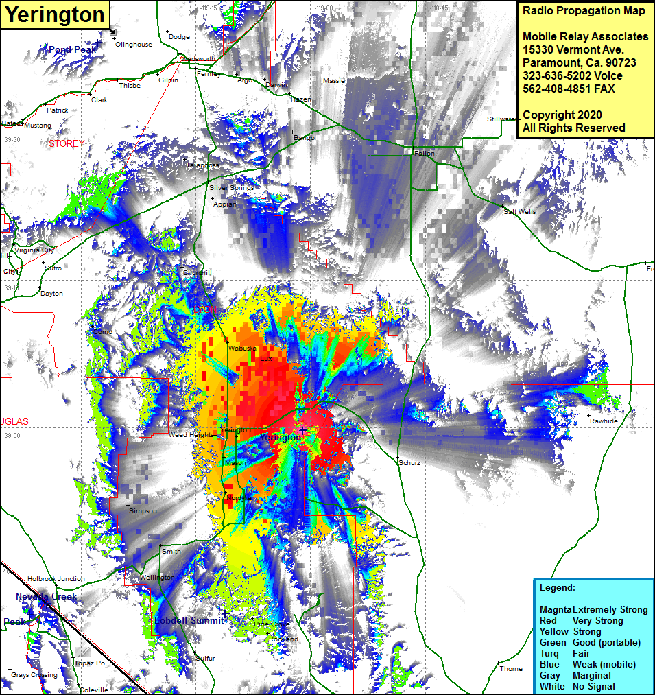 Yerington Coverage |
| Latitude: | 038 59 44.2N | 38.9956111 |
| Longitude: | 119 01 03.4W | -119.0176111 |
| Feet | Meters | |
| Ground Elevation: | 5433.0 | 1656.0 |
| HAAT: | 661.9 | 201.7 |
| City: | Yerington | |
| County: | Lyon | |
| State: | Nevada |
This is not an MRA Owned Site. For space rental contact the site owner.
Do you own or manage this site? Click Here
Would you like to add a site to the Google Earth Map?? Click Here
Site Coverage: Coverage of the southcentral portion of Lyon County, Yerington, Mason, Nordyke, Weed Heights, Wabuska, Smith, Wellington, Pine Grove, Rockland, Silver Springs, Appian, Bango, Talapoosa, Churchill, Como, Sipmson, Fallon, Massie, Darwin, Argo