Jal I
| Site Name: | Jal I |  Jal I Coverage |
| Latitude: | 032 04 34.7N | 32.0763056 |
| Longitude: | 103 10 47.2W | -103.1797778 |
| Feet | Meters | |
| Ground Elevation: | 2982.0 | 908.9 |
| HAAT: | 152.0 | 46.3 |
| City: | Jal | |
| County: | Lea South | |
| State: | New Mexico |
This is not an MRA Owned Site. For space rental contact the site owner.
Do you own or manage this site? Click Here
Would you like to add a site to the Google Earth Map?? Click Here
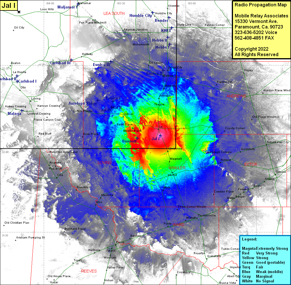
Site Coverage: Coverage of Jal, Teague, Johnson, Maypens, Eunice, Jones City, Warren, Hobbs, Air Base City, State Line, Paynes Corner, Seminole, Fairview, Florey, Frankel City, Waldon Place Windmill, Old Place Windmill, Coyote Corner, Cheyenne, Magwalt, Vesrue, Kermit, Wink, Three Corner Windmill, Wickett, Pyote, Thorntonville, Cowden Place, Metz, Judkins, Badger, Penwell, Douro, Arcade, Odessa, Notrees, Turnbaugh Corner, Goldsmith, North Cowden, Gardendale, Schaubauer City, Coyanosa, Royalty, Bennett, Andrews Place, Red Bluff, Robinson Arms Land, Angeles, Red Bluff, Orla, Riverton, Mentone, Arno, Barstow, Pecos, Mann, Locker, Worsham, Valley Farm, Hermosa, Medlin, Baird Place Ochoa, Cotton Place, Rose Place, Lookout Crossing, Harroun Crossing, Loving, Otis, Pen Place Windmill, Maljamar, Arkansas Junction, Monument, Oil Center, Johnson, Teague
