Logan
| Site Name: | Logan |  Logan Coverage |
| Latitude: | 035 22 02.7N | 35.3674167 |
| Longitude: | 103 24 45.3W | -103.4125833 |
| Feet | Meters | |
| Ground Elevation: | 3828.0 | 1166.8 |
| HAAT: | 75.7 | 23.1 |
| City: | Logan | |
| County: | Quay | |
| State: | New Mexico |
This is not an MRA Owned Site. For space rental contact the site owner.
Do you own or manage this site? Click Here
Would you like to add a site to the Google Earth Map?? Click Here
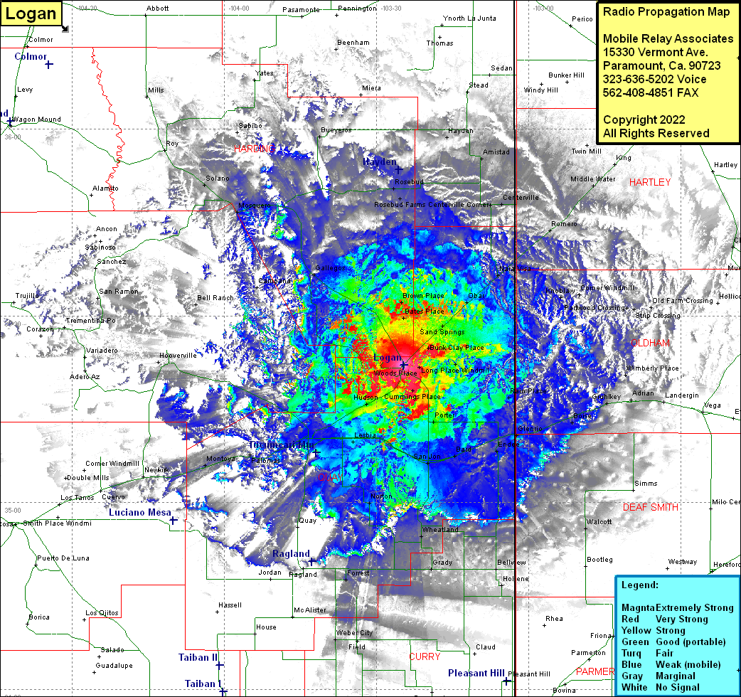
Site Coverage: Coverage of Woods Place, Long Place Windmill, Bunk Clay Place, Sand Springs, Obar, Nara Visa, Brown Place, Rosebud Farms, Hayden, Stead, Armistad, Centerville, Centerville Corner, Sedan, Twin Mill, Middle Water, Romero, King, Parkwood Crossing, Corner Windmill, Knoblaw, Channing, Logan, Woods Place, Cummings Place, Porter, Bard, San Jon, Endee, Glenrio, Boise, Wheatland, Grady, Broadview, Bellview, Hollene, Walcott, Landergin, Adrian, Gruhlkey, Rain Place, Wimberly Place, Hendricks Place, Mater, Hudson, Lesbia, Tucumcari, Hargis, Polomas, Montoya, Norton, Quay, Ragland, Forrest, Newkirk, Hooverville, Bates Place, Brown Place, Gallegos, Campana, Bell Ranch, Conchas, Sanchez, San Ramon, Solano, Roy, Otexline, Sabina, Albert, Bueyeros, Rosebud, Rosebud Farms, Mills
