Lookout Peak II
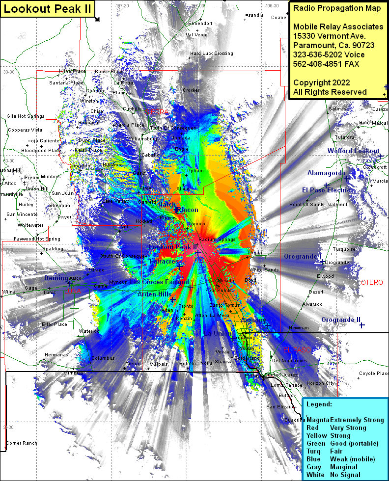
| Site Name: | Lookout Peak II |  Lookout Peak II Coverage |
| Latitude: | 032 27 19.0N | 32.4552778 |
| Longitude: | 106 55 25.3W | -106.9236944 |
| Feet | Meters | |
| Ground Elevation: | 5643.0 | 1720.0 |
| HAAT: | 1333.2 | 406.4 |
| City: | Leasburg | |
| County: | Dona Ana | |
| State: | New Mexico |
This is not an MRA Owned Site. For space rental contact the site owner.
Do you own or manage this site? Click Here
Would you like to add a site to the Google Earth Map?? Click Here
Site Coverage: Coverage of Fort Selden, Point of Sands, Omlee, Alamagordo, La Luz, High Rolls, Salinas, Oscura, Kimmons, Bent, Old Wright Place, Dona Ana, Picacho, Fairacres, Las Creces, Mesilla, Mesilla Park, Four Points, San Pablo, Santo Tomas, San Miguel, Mesquite, Las Mesa, Vado, Berino, Chamberino, Anthony, La Tuna, Vinton, La Union, Vevay, Lanak, Rutter, Noria, Boyd, White Sands, Organ, Newman, Canutillo, Borderland, Montoya, Lizard, Mastodon, Orange, Strauss, Courchesne, Coronado Hills, Sunrise Acres, Aero Vista, Cielo Vista, Loma Terrace, Horizon City, Newman, Elwood, Orogrande, Boyd, White Sands, Organ, Truth or Consequence, Florida, Mirage, Came, Myndus, Cambray, Dona, Aden, Pronto, Menzin, Afton, Potrillo, Malpais, Arena, Columbus, Mimbres, Hermanas, Eller Place, Deming, Peruhill, Tunis, Gage, Radium Springs, Kimball Place, Tonuco, Rincon, Hatch, Hockett, Salem, Grama, Alivio, Upham, Engle, Comer Windmill, Jomada, Deny, Arrey, Oasis, Caballo, Las Palomas, Williamsburg, Truth Or Consequence, Hot Springs Landing, Placitas, La Petra, Chaves Place, Chloride, Hillsboro, Lake Valley, Middle Place Windmill, Nutt
