Orogrande I
| Site Name: | Orogrande I |  Orogrande I Coverage |
| Latitude: | 032 24 10.2N | 32.4028333 |
| Longitude: | 106 05 36.6W | -106.0935000 |
| Feet | Meters | |
| Ground Elevation: | 4502.0 | 1372.2 |
| HAAT: | 434.4 | 132.4 |
| City: | Orogrande | |
| County: | Otero | |
| State: | New Mexico |
This is not an MRA Owned Site. For space rental contact the site owner.
Do you own or manage this site? Click Here
Would you like to add a site to the Google Earth Map?? Click Here
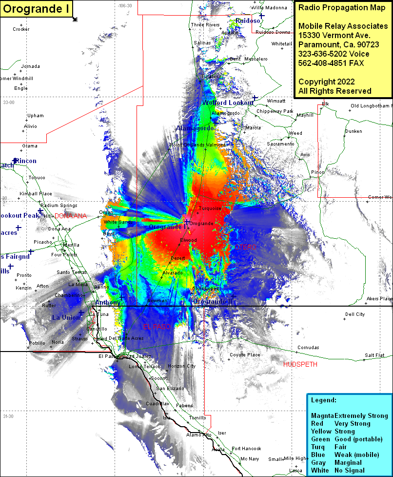
Site Coverage: Coverage of Turquoise, Old Wright Place, Valmont, Omee, Alamogordo, La Luz, Kearney, Tularosa, Apache, Carrizo, Whitetail, Cloudcroft, Avis, Orogrande, Luis Lopez, Elwood, Desert, Alavarado, Newman, Del Norte Acres, Sunrise Acres, Planeport, Aero Vista, Cielo Vista, Horizon City, Ysleta, Belen, Socorro, Buford, San Jose, El Paso, Cuidad Juarez, Nuway, Vinton, La Union, Ojito, Strauss, Mastodon, Vevay, Lanark, Rutter, Afton, Noria, Potrillo, White Sands, Boyd, Point of Sands, US HIghway 54 from Juarez to Tularosa, US Highway 70 from US Highway 54 to Organ
