Pleasant Hill II
| Site Name: | Pleasant Hill II |  Pleasant Hill II Coverage |
| Latitude: | 034 31 18.1N | 34.5216944 |
| Longitude: | 103 04 27.9W | -103.0744167 |
| Feet | Meters | |
| Ground Elevation: | 4247.0 | 1294.5 |
| HAAT: | 201.3 | 61.4 |
| City: | Pleasant Hill | |
| County: | Curry | |
| State: | New Mexico |
This is not an MRA Owned Site. For space rental contact the site owner.
Do you own or manage this site? Click Here
Would you like to add a site to the Google Earth Map?? Click Here
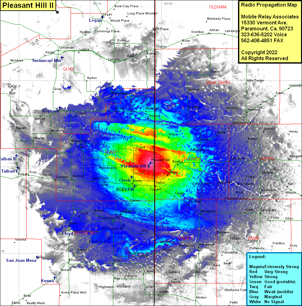
Site Coverage: Coverage of Bevina, Parmerton, Rhea, Friona, Black, Tam Anne, Dimmitt, Nazareth, Jumbo, Easter, Friona, Black, Summerfield, Hereford, Joel, Westway, Dawn, Milo Center, Bootleg, Walcott, Simms, Glenrio, Wilsey, Bovina, Roy, Flagg, Lazboddie, Clays Corner, Big Square, Sunnyside, Dodd, Pleasant Valley, Lariat, Progress, Farwell, Texico, Muleshoe, Earth, Springlake, Circle, Amherst, Sudan, Fairview, Bula, Needmore, Baileyboro, Uhereford, Stegall, Goodland, Maple, Clovis, Portair, Grier, Gallaher, Saint Vrain, Melrose, Cantara, Krider, Tolar, Cameo, Midway, Portales, Bethel, Floyd, Upton, Yerba, Arch, Delphos, Kermit, Rogers, Inez, Dora, Causey, Garrison, Richland, Pep, Lingo, Highway, Elida, Tomero, Claud, Field, Weber City, McAlister, House, Hassell, Jordan, Ragland, Forrest, Grady, Broadview, Bellview, Hollene, Wheatland, San Jon, Bard, Lesbia, Mater
