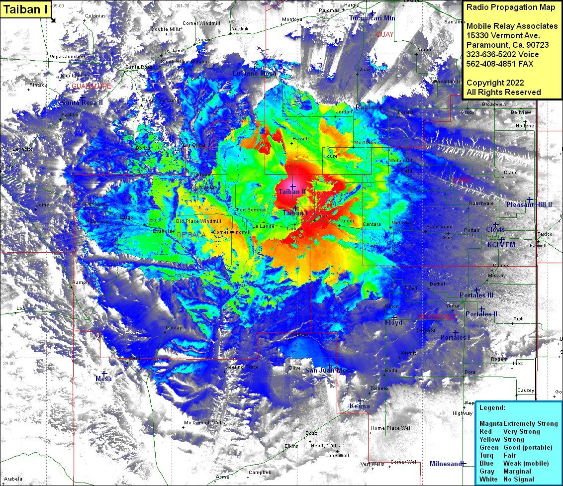
Taiban II
| Site Name: | Taiban II |  Taiban II Coverage |
| Latitude: | 034 33 52.0N | 34.5644444 |
| Longitude: | 104 01 05.1W | -104.0180833 |
| Feet | Meters | |
| Ground Elevation: | 4744.0 | 1446.0 |
| HAAT: | 351.5 | 107.2 |
| City: | Taiban | |
| County: | De Baca | |
| State: | New Mexico |
This is not an MRA Owned Site. For space rental contact the site owner.
Do you own or manage this site? Click Here
Would you like to add a site to the Google Earth Map?? Click Here
Site Coverage: Coverage of Hassell, House, McAlister, Weber City, Field, Ranchvale, Claud, Hollene, Bellview, Broadview, Grady, Wheatland, Forrest, Ragland, Jordan, Quay, Norton, Palomas, Lesbia, Hargis, Taiban, Tolar, Krider, Cantara, Melrose, Saint Vrain, Grier, Portair, Gallaher, Clovis, Texico, Farwell, Wilsey, Cameo, Midway, Portales, Bethel, Floyd, Upton, Yerba, Arch, Rogers, Dora, Delphos, Kermit, Elica, Tornero, Kenna, Home Place Well, Lone Wolf, Robertson Wells, Beatty Wells, Boaz, La Lande, Fort Sumner, Corner WIndmill, Agudo, Ricardo, Dunlap, Deering Place, Ciruela, Olive, Mesa, Ramon, Old Place Windmill, Evanola, Yeso, Largo, Buchanan, Cardenas, Joffre, Guadalupe, Salado, Los Ojitos, Borica, Pastura, Smith Place Windmill, Arabella, Santa Rose, Los Tanos
