Allison Peak
| Site Name: | Allison Peak | 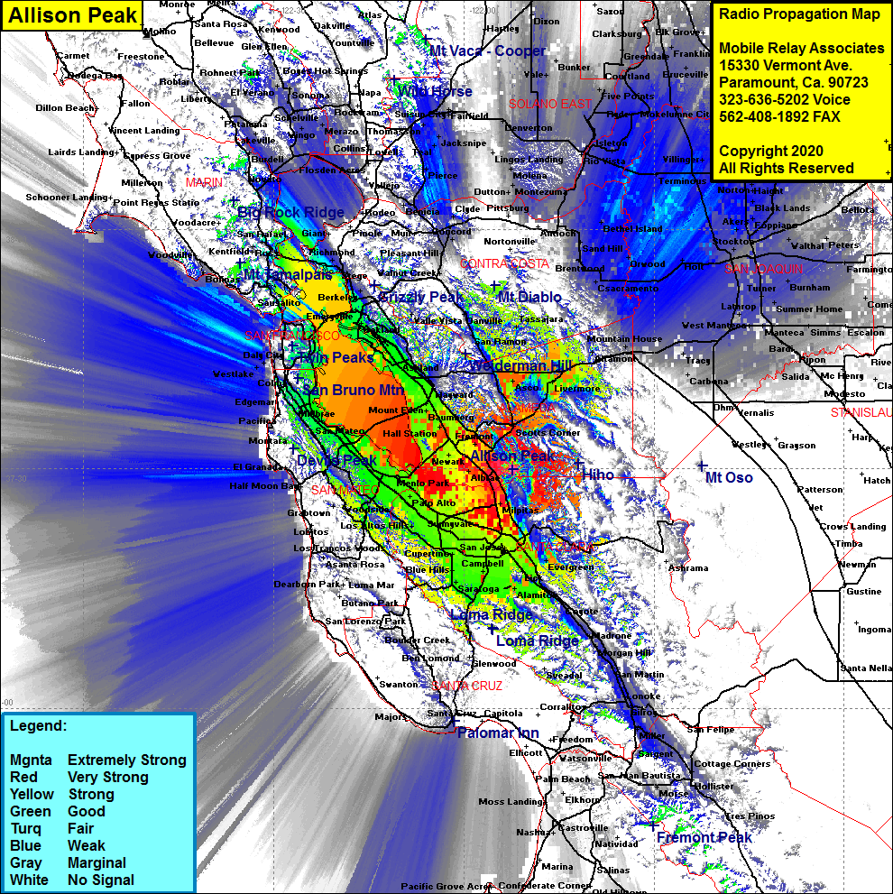 Allison Peak Coverage |
| Latitude: | 037 29 58.7N | 37.4996389 |
| Longitude: | 121 52 19.7W | -121.8721389 |
| Feet | Meters | |
| Ground Elevation: | 2639.8 | 804.6 |
| HAAT: | 2018.5 | 615.2 |
| City: | Fremont | |
| County: | Alameda | |
| State: | California |
This is not an MRA Owned Site. For space rental contact the site owner.
Do you own or manage this site? Click Here
Would you like to add a site to the Google Earth Map?? Click Here
Site Coverage: Coverage of the San Francisco Bay, East Bay, West Bay, South Bay, Los Gatos, south on US101 through Coyote, Morgan Hill, Gilroy & Miller, Highway 680 through Pleasanton, Livermore, Scotts Corner, mobile coverage of portions of the San Joaquin Valley including Stockton, Molena, Trull, Lathrop