Ball Mtn
| Site Name: | Ball Mtn |  Ball Mtn Coverage |
| Latitude: | 041 47 43.0N | 41.7952778 |
| Longitude: | 122 09 19.7W | -122.1554722 |
| Feet | Meters | |
| Ground Elevation: | 7779.0 | 2371.0 |
| HAAT: | 2693.4 | 820.9 |
| City: | Mt Hebron | |
| County: | Siskiyou | |
| State: | California |
This is not an MRA Owned Site. For space rental contact the site owner.
Do you own or manage this site? Click Here
Would you like to add a site to the Google Earth Map?? Click Here
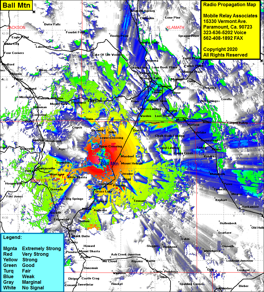
Site Coverage: Coverage of the central portion of the northern border of California and into Oregon, Macdoel, Jerome, Penoyar, Tennant, Cougar, Andesite, Hotlum, Bolam, Weed, Edgewood, Igerna, Big Springs, Gillis, Dorris, Worden, Teters Landing, Stuken, Dehlinger, Henley, Olene, Altamont, Klamath Falls, Bonanza, Yonna, Dairy, Moyina, Hildebrand, Lone Rock Place, Beatty, Merrill, Malone, Texum, Midland, King Cole, Mount View, Gillis, Henley, Grenada, Bog Springs, Gazelle, Hawkinsville, Yreka
