Banner Mtn
| Site Name: | Banner Mtn | 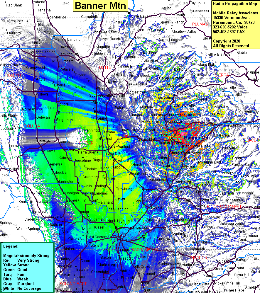 Banner Mtn Coverage |
| Latitude: | 039 14 46.6N | 39.2462778 |
| Longitude: | 120 57 51.8W | -120.9643889 |
| Feet | Meters | |
| Ground Elevation: | 3809.1 | 1161.0 |
| HAAT: | 1090.1 | 332.2 |
| City: | Nevada City | |
| County: | Nevada | |
| State: | California |
This is not an MRA Owned Site. For space rental contact the site owner.
Do you own or manage this site? Click Here
Would you like to add a site to the Google Earth Map?? Click Here
Site Coverage: Coverage of Gold Flat, Nevada City, White Spot, Grass Valley, The Oaks, Peardale, Chicago Park, Shady Glen, Cape Horn, Plumtree Crossing, Meadow Vista, Heather Glen, Wolf, Newtown, Alta Hill, Bitney Corner, Oregon House, Camptonville, Weeds Point, Oak Valley, Higgins Corner, Dew Drop, La Bar Meadows, Magra, Gold Run, Monte Vista, Alta, Baxter, Forest Hill, Yankee Jims, Iowa Hill, Volcanoville, Meadow Vista, Auburn, Newcastle, Loomis, Rocklin, Virginiatown, Lincoln