Boulder Ridge
| Site Name: | Boulder Ridge | 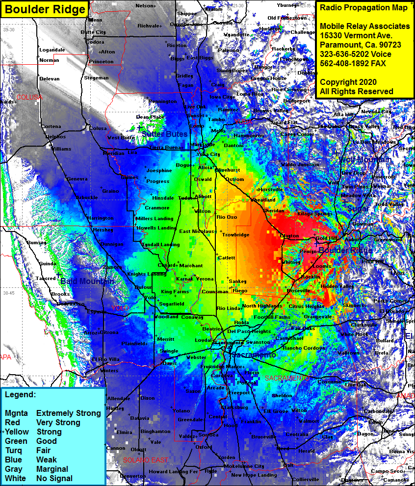 Boulder Ridge Coverage |
| Latitude: | 038 52 27.2N | 38.8742222 |
| Longitude: | 121 10 28.2W | -121.1745000 |
| Feet | Meters | |
| Ground Elevation: | 945.0 | 288.0 |
| HAAT: | 485.5 | 148.0 |
| City: | Newcastle | |
| County: | Placer | |
| State: | California |
This is not an MRA Owned Site. For space rental contact the site owner.
Do you own or manage this site? Click Here
Would you like to add a site to the Google Earth Map?? Click Here
Site Coverage: Coverage of the San Joaquin Valley from Stockton in the south to Bayliss in the north, Rocklin, Loomis, Penrys, Newcastle Ophir, Auburn, Gold Hill, Virginiatown, Lincoln, Whitney, Clayton, Kilaga Springs, Hidden Valley, Citrus Heights, Pilot Hill, Bowman, Nielsburg, Clipper Gap, Elders Corner, Meadow Vista, Heather Glen, Twin Pines, Weimar, Higgins Corner, Wolf, Dew Drop, Cherry Creek Acres, Lander Crossing, Colfax, Cape Horn, Shady Glen, Greenwood, Fornis, Buffalo Hill, Spanish Flat, Kelsey, Lotus