Bunchgrass Mtn
| Site Name: | Bunchgrass Mtn | 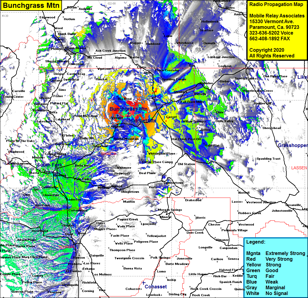 Bunchgrass Mtn Coverage |
| Latitude: | 040 55 30.5N | 40.9251389 |
| Longitude: | 121 49 29.5W | -121.8248611 |
| Feet | Meters | |
| Ground Elevation: | 5482.0 | 1670.9 |
| HAAT: | 2061.8 | 628.5 |
| City: | Hillcrest | |
| County: | Shasta | |
| State: | California |
This is not an MRA Owned Site. For space rental contact the site owner.
Do you own or manage this site? Click Here
Would you like to add a site to the Google Earth Map?? Click Here
Site Coverage: Coverage of Redding, Anderson, Red Bluff, Loomis Corner, Palo Cedro, Enterprise, Girvan, Centerville, Cloverdale, Olinda, Igo, Bella Vista, Ingot, Sugarloaf, Round Mtn, Montgomery Creek, Casset, Hillcrest, Burney, Fall River Mills, Bieber, Glenburn, Dana, Spalding Corner, Harlow Place, Hammond Crossing, Pondosa, Big Bend, Wengler, Bully Hill, Day, Whitehorse