Cholame Hills
| Site Name: | Cholame Hills | 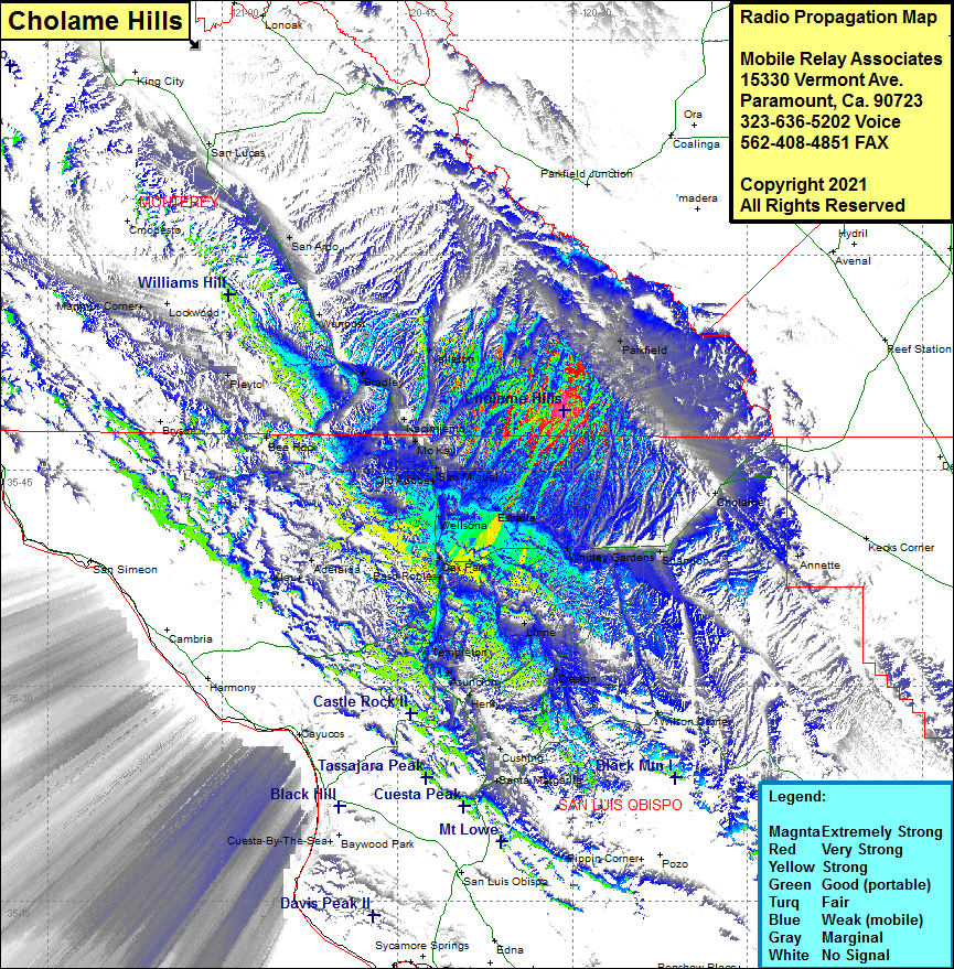 Cholame Hills Coverage |
| Latitude: | 035 49 10.2N | 35.8195000 |
| Longitude: | 120 30 42.9W | -120.5119167 |
| Feet | Meters | |
| Ground Elevation: | 1833.0 | 558.7 |
| HAAT: | 230.1 | 70.1 |
| City: | San Miguel | |
| County: | Monterey | |
| State: | California |
This is not an MRA Owned Site. For space rental contact the site owner.
Do you own or manage this site? Click Here
Would you like to add a site to the Google Earth Map?? Click Here
Site Coverage: Coverage of Parkfield, Shandon, Annette, Whitley Gardens, Estrella, San Miguel, Old Adobe, Wellsona, Naciemiento, Bradley, Valleton, Wunpost, San Ardo, Bee Rock, Pleyto, Martinus Corner, San Lucas, Adelaida, Templeton, Linne, Wilson Corner